You are here: Home > Network List > G - GEOSCOPE Stations List
> Station PPTF Pamatai - Papeete - Tahiti island - French Polynesia, France > Earthquake Result Viewer
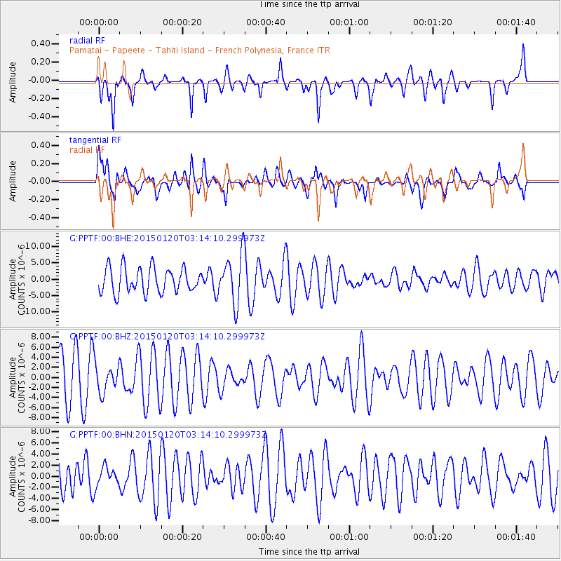
PPTF Pamatai - Papeete - Tahiti island - French Polynesia, France - Earthquake Result Viewer
*The percent match for this event was below the threshold and hence no stack was calculated.
| Earthquake location: |
Philippine Islands Region |
| Earthquake latitude/longitude: |
5.9/127.1 |
| Earthquake time(UTC): |
2015/01/20 (020) 03:02:16 GMT |
| Earthquake Depth: |
112 km |
| Earthquake Magnitude: |
5.1 MW, 5.0 mb |
| Earthquake Catalog/Contributor: |
ISC/ISC |
|
| Network: |
G GEOSCOPE |
| Station: |
PPTF Pamatai - Papeete - Tahiti island - French Polynesia, France |
| Lat/Lon: |
17.59 S/149.57 W |
| Elevation: |
705 m |
|
| Distance: |
85.5 deg |
| Az: |
108.119 deg |
| Baz: |
277.592 deg |
| Ray Param: |
$rayparam |
*The percent match for this event was below the threshold and hence was not used in the summary stack. |
|
| Radial Match: |
66.80218 % |
| Radial Bump: |
348 |
| Transverse Match: |
48.748882 % |
| Transverse Bump: |
400 |
| SOD ConfigId: |
3390531 |
| Insert Time: |
2019-04-16 03:11:32.317 +0000 |
| GWidth: |
2.5 |
| Max Bumps: |
400 |
| Tol: |
0.001 |
|
Signal To Noise
| Channel | StoN | STA | LTA |
| G:PPTF:00:BHZ:20150120T03:14:10.299973Z | 0.703001 | 2.5412817E-6 | 3.6149045E-6 |
| G:PPTF:00:BHN:20150120T03:14:10.299973Z | 0.49896637 | 1.5961549E-6 | 3.198923E-6 |
| G:PPTF:00:BHE:20150120T03:14:10.299973Z | 2.0566647 | 7.762544E-6 | 3.774336E-6 |
| Arrivals |
| Ps | |
| PpPs | |
| PsPs/PpSs | |


