You are here: Home > Network List > UW - Pacific Northwest Regional Seismic Network Stations List
> Station MRBL Marblemount, WA, USA > Earthquake Result Viewer
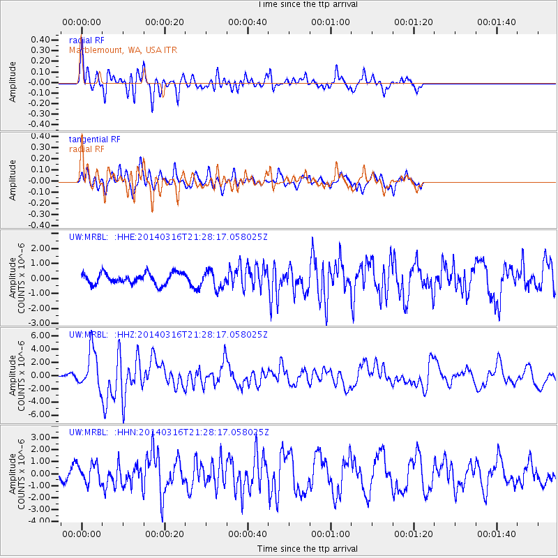
MRBL Marblemount, WA, USA - Earthquake Result Viewer
*The percent match for this event was below the threshold and hence no stack was calculated.
| Earthquake location: |
Near Coast Of Northern Chile |
| Earthquake latitude/longitude: |
-19.9/-70.6 |
| Earthquake time(UTC): |
2014/03/16 (075) 21:16:30 GMT |
| Earthquake Depth: |
20 km |
| Earthquake Magnitude: |
6.7 MWW, 6.7 MWC, 7.0 MI |
| Earthquake Catalog/Contributor: |
NEIC PDE/NEIC COMCAT |
|
| Network: |
UW Pacific Northwest Regional Seismic Network |
| Station: |
MRBL Marblemount, WA, USA |
| Lat/Lon: |
48.52 N/121.48 W |
| Elevation: |
75 m |
|
| Distance: |
81.8 deg |
| Az: |
328.606 deg |
| Baz: |
132.509 deg |
| Ray Param: |
$rayparam |
*The percent match for this event was below the threshold and hence was not used in the summary stack. |
|
| Radial Match: |
74.2442 % |
| Radial Bump: |
400 |
| Transverse Match: |
64.22938 % |
| Transverse Bump: |
400 |
| SOD ConfigId: |
626651 |
| Insert Time: |
2014-04-21 07:51:32.920 +0000 |
| GWidth: |
2.5 |
| Max Bumps: |
400 |
| Tol: |
0.001 |
|
Signal To Noise
| Channel | StoN | STA | LTA |
| UW:MRBL: :HHZ:20140316T21:28:17.058025Z | 12.36529 | 2.9682424E-6 | 2.4004635E-7 |
| UW:MRBL: :HHN:20140316T21:28:17.058025Z | 1.8600563 | 7.8849223E-7 | 4.2390772E-7 |
| UW:MRBL: :HHE:20140316T21:28:17.058025Z | 1.6026095 | 5.9695157E-7 | 3.7248722E-7 |
| Arrivals |
| Ps | |
| PpPs | |
| PsPs/PpSs | |


