You are here: Home > Network List > TA - USArray Transportable Network (new EarthScope stations) Stations List
> Station J04D Umpqua National Forest, Toketee, OR, USA > Earthquake Result Viewer
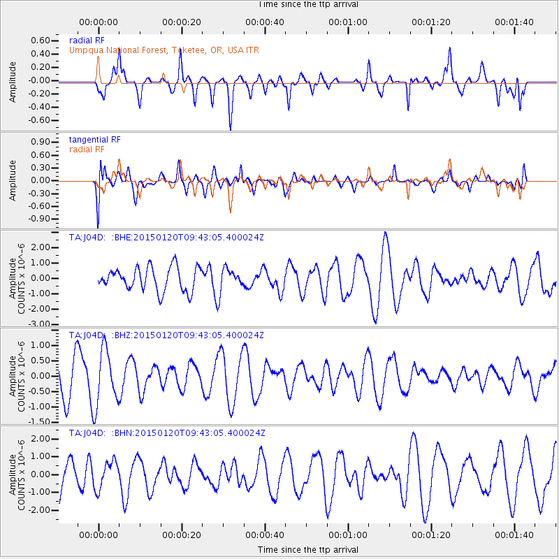
J04D Umpqua National Forest, Toketee, OR, USA - Earthquake Result Viewer
*The percent match for this event was below the threshold and hence no stack was calculated.
| Earthquake location: |
Eastern Kazakhstan |
| Earthquake latitude/longitude: |
49.0/78.9 |
| Earthquake time(UTC): |
2015/01/20 (020) 09:30:54 GMT |
| Earthquake Depth: |
7.2 km |
| Earthquake Magnitude: |
4.9 mb, 4.8 mb, 4.1 MS |
| Earthquake Catalog/Contributor: |
ISC/ISC |
|
| Network: |
TA USArray Transportable Network (new EarthScope stations) |
| Station: |
J04D Umpqua National Forest, Toketee, OR, USA |
| Lat/Lon: |
43.24 N/122.11 W |
| Elevation: |
1948 m |
|
| Distance: |
86.3 deg |
| Az: |
15.205 deg |
| Baz: |
346.331 deg |
| Ray Param: |
$rayparam |
*The percent match for this event was below the threshold and hence was not used in the summary stack. |
|
| Radial Match: |
55.733665 % |
| Radial Bump: |
352 |
| Transverse Match: |
44.14894 % |
| Transverse Bump: |
400 |
| SOD ConfigId: |
3390531 |
| Insert Time: |
2019-04-16 03:25:38.669 +0000 |
| GWidth: |
2.5 |
| Max Bumps: |
400 |
| Tol: |
0.001 |
|
Signal To Noise
| Channel | StoN | STA | LTA |
| TA:J04D: :BHZ:20150120T09:43:05.400024Z | 2.0598702 | 8.826189E-7 | 4.2848276E-7 |
| TA:J04D: :BHN:20150120T09:43:05.400024Z | 0.8700678 | 7.803296E-7 | 8.968607E-7 |
| TA:J04D: :BHE:20150120T09:43:05.400024Z | 0.8456193 | 6.4436983E-7 | 7.6200934E-7 |
| Arrivals |
| Ps | |
| PpPs | |
| PsPs/PpSs | |


