You are here: Home > Network List > TA - USArray Transportable Network (new EarthScope stations) Stations List
> Station P54A Burton, WV, USA > Earthquake Result Viewer
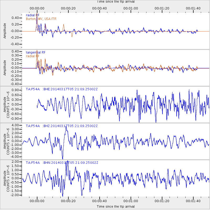
P54A Burton, WV, USA - Earthquake Result Viewer
*The percent match for this event was below the threshold and hence no stack was calculated.
| Earthquake location: |
Near Coast Of Northern Chile |
| Earthquake latitude/longitude: |
-20.0/-70.9 |
| Earthquake time(UTC): |
2014/03/17 (076) 05:11:34 GMT |
| Earthquake Depth: |
17 km |
| Earthquake Magnitude: |
6.2 MWW, 6.2 MWB, 6.5 MWC |
| Earthquake Catalog/Contributor: |
NEIC PDE/NEIC COMCAT |
|
| Network: |
TA USArray Transportable Network (new EarthScope stations) |
| Station: |
P54A Burton, WV, USA |
| Lat/Lon: |
39.61 N/80.48 W |
| Elevation: |
473 m |
|
| Distance: |
60.0 deg |
| Az: |
351.438 deg |
| Baz: |
169.558 deg |
| Ray Param: |
$rayparam |
*The percent match for this event was below the threshold and hence was not used in the summary stack. |
|
| Radial Match: |
77.10996 % |
| Radial Bump: |
400 |
| Transverse Match: |
67.43486 % |
| Transverse Bump: |
400 |
| SOD ConfigId: |
626651 |
| Insert Time: |
2014-04-21 08:14:54.545 +0000 |
| GWidth: |
2.5 |
| Max Bumps: |
400 |
| Tol: |
0.001 |
|
Signal To Noise
| Channel | StoN | STA | LTA |
| TA:P54A: :BHZ:20140317T05:21:09.25002Z | 1.2885339 | 6.0609267E-7 | 4.7037386E-7 |
| TA:P54A: :BHN:20140317T05:21:09.25002Z | 1.9147385 | 5.637966E-7 | 2.9445096E-7 |
| TA:P54A: :BHE:20140317T05:21:09.25002Z | 1.0699165 | 3.0038183E-7 | 2.8075257E-7 |
| Arrivals |
| Ps | |
| PpPs | |
| PsPs/PpSs | |


