You are here: Home > Network List > TA - USArray Transportable Network (new EarthScope stations) Stations List
> Station W57A Gilead, NC, USA > Earthquake Result Viewer
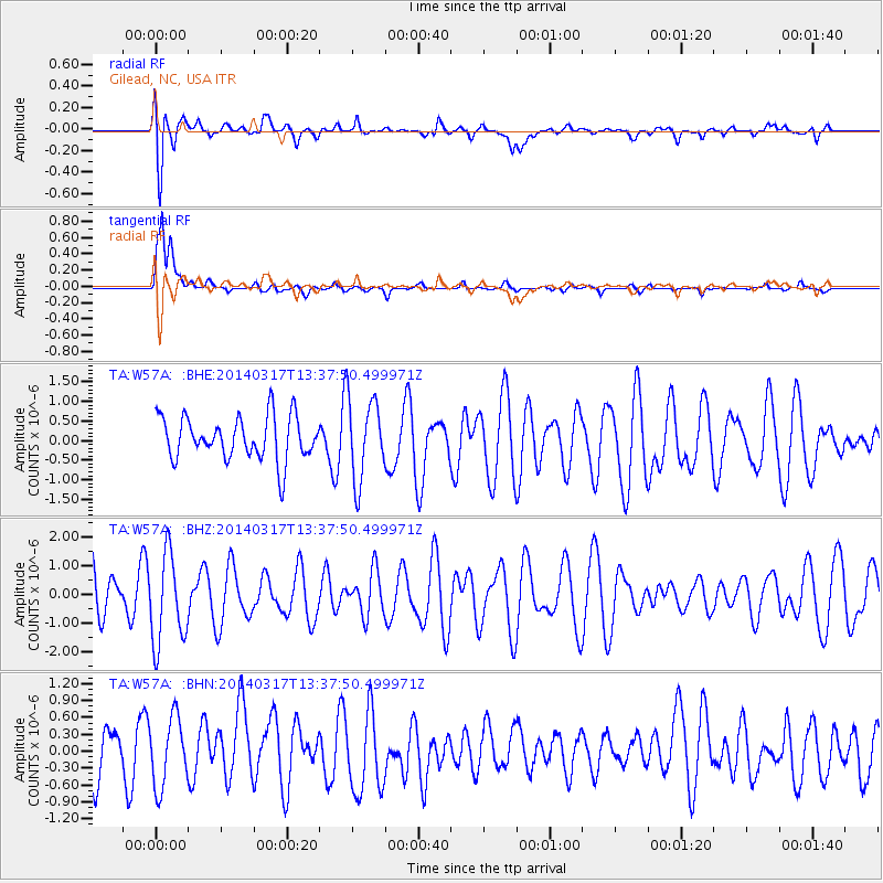
W57A Gilead, NC, USA - Earthquake Result Viewer
*The percent match for this event was below the threshold and hence no stack was calculated.
| Earthquake location: |
South Georgia Island Region |
| Earthquake latitude/longitude: |
-53.2/-32.3 |
| Earthquake time(UTC): |
2014/03/17 (076) 13:24:48 GMT |
| Earthquake Depth: |
5.4 km |
| Earthquake Magnitude: |
5.6 MB, 5.8 MWB, 5.9 MWC |
| Earthquake Catalog/Contributor: |
NEIC PDE/NEIC COMCAT |
|
| Network: |
TA USArray Transportable Network (new EarthScope stations) |
| Station: |
W57A Gilead, NC, USA |
| Lat/Lon: |
35.15 N/79.99 W |
| Elevation: |
85 m |
|
| Distance: |
97.2 deg |
| Az: |
322.338 deg |
| Baz: |
153.318 deg |
| Ray Param: |
$rayparam |
*The percent match for this event was below the threshold and hence was not used in the summary stack. |
|
| Radial Match: |
50.33497 % |
| Radial Bump: |
400 |
| Transverse Match: |
85.813675 % |
| Transverse Bump: |
400 |
| SOD ConfigId: |
626651 |
| Insert Time: |
2014-04-21 08:25:07.530 +0000 |
| GWidth: |
2.5 |
| Max Bumps: |
400 |
| Tol: |
0.001 |
|
Signal To Noise
| Channel | StoN | STA | LTA |
| TA:W57A: :BHZ:20140317T13:37:50.499971Z | 2.070688 | 1.5515843E-6 | 7.493086E-7 |
| TA:W57A: :BHN:20140317T13:37:50.499971Z | 1.186441 | 6.5433954E-7 | 5.5151463E-7 |
| TA:W57A: :BHE:20140317T13:37:50.499971Z | 1.8879235 | 1.0397436E-6 | 5.5073394E-7 |
| Arrivals |
| Ps | |
| PpPs | |
| PsPs/PpSs | |


