You are here: Home > Network List > CI - Caltech Regional Seismic Network Stations List
> Station CIA Catalina Island Airport, California, USA > Earthquake Result Viewer
CIA Catalina Island Airport, California, USA - Earthquake Result Viewer

| Earthquake location: |
Caribbean Sea |
| Earthquake latitude/longitude: |
19.0/-81.4 |
| Earthquake time(UTC): |
2004/12/14 (349) 23:20:13 GMT |
| Earthquake Depth: |
10 km |
| Earthquake Magnitude: |
6.2 MB, 6.7 MS, 6.8 MW, 6.8 MW |
| Earthquake Catalog/Contributor: |
WHDF/NEIC |
|
| Network: |
CI Caltech Regional Seismic Network |
| Station: |
CIA Catalina Island Airport, California, USA |
| Lat/Lon: |
33.40 N/118.42 W |
| Elevation: |
428 m |
|
| Distance: |
36.0 deg |
| Az: |
301.027 deg |
| Baz: |
104.185 deg |
| Ray Param: |
0.07692759 |
| Estimated Moho Depth: |
22.5 km |
| Estimated Crust Vp/Vs: |
1.75 |
| Assumed Crust Vp: |
6.048 km/s |
| Estimated Crust Vs: |
3.456 km/s |
| Estimated Crust Poisson's Ratio: |
0.26 |
|
| Radial Match: |
93.18395 % |
| Radial Bump: |
304 |
| Transverse Match: |
76.252426 % |
| Transverse Bump: |
400 |
| SOD ConfigId: |
2459 |
| Insert Time: |
2010-02-25 20:59:05.949 +0000 |
| GWidth: |
2.5 |
| Max Bumps: |
400 |
| Tol: |
0.001 |
|
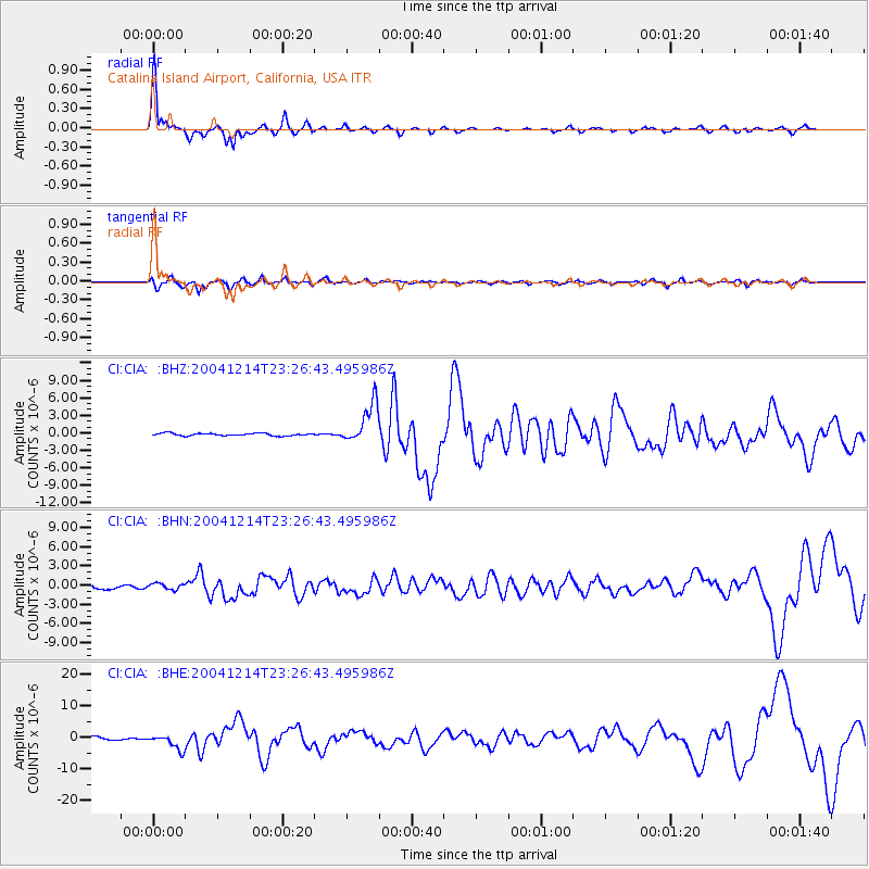
Signal To Noise
| Channel | StoN | STA | LTA |
| CI:CIA: :BHN:20041214T23:26:43.495986Z | 0.82238394 | 4.914962E-7 | 5.976481E-7 |
| CI:CIA: :BHE:20041214T23:26:43.495986Z | 4.657047 | 2.3191344E-6 | 4.9798393E-7 |
| CI:CIA: :BHZ:20041214T23:26:43.495986Z | 16.178093 | 3.4433385E-6 | 2.1283958E-7 |
| Arrivals |
| Ps | 3.0 SECOND |
| PpPs | 9.6 SECOND |
| PsPs/PpSs | 13 SECOND |


