You are here: Home > Network List > WY - Yellowstone Wyoming Seismic Network Stations List
> Station YHH Holmes Hill, YNP, WY, USA > Earthquake Result Viewer
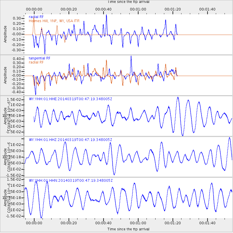
YHH Holmes Hill, YNP, WY, USA - Earthquake Result Viewer
*The percent match for this event was below the threshold and hence no stack was calculated.
| Earthquake location: |
New Britain Region, P.N.G. |
| Earthquake latitude/longitude: |
-5.3/152.9 |
| Earthquake time(UTC): |
2014/03/19 (078) 00:34:15 GMT |
| Earthquake Depth: |
20 km |
| Earthquake Magnitude: |
5.8 MWW, 5.6 MWB, 5.7 MWC |
| Earthquake Catalog/Contributor: |
NEIC PDE/NEIC COMCAT |
|
| Network: |
WY Yellowstone Wyoming Seismic Network |
| Station: |
YHH Holmes Hill, YNP, WY, USA |
| Lat/Lon: |
44.79 N/110.85 W |
| Elevation: |
2717 m |
|
| Distance: |
98.1 deg |
| Az: |
45.647 deg |
| Baz: |
270.62 deg |
| Ray Param: |
$rayparam |
*The percent match for this event was below the threshold and hence was not used in the summary stack. |
|
| Radial Match: |
64.67426 % |
| Radial Bump: |
335 |
| Transverse Match: |
66.08927 % |
| Transverse Bump: |
294 |
| SOD ConfigId: |
626651 |
| Insert Time: |
2014-04-21 09:03:55.097 +0000 |
| GWidth: |
2.5 |
| Max Bumps: |
400 |
| Tol: |
0.001 |
|
Signal To Noise
| Channel | StoN | STA | LTA |
| WY:YHH:01:HHZ:20140319T00:47:19.348005Z | 1.0364617 | 4.310053E-9 | 4.1584296E-9 |
| WY:YHH:01:HHN:20140319T00:47:19.348005Z | 2.373081 | 1.0568867E-8 | 4.4536477E-9 |
| WY:YHH:01:HHE:20140319T00:47:19.348005Z | 0.39718485 | 1.7470757E-9 | 4.3986463E-9 |
| Arrivals |
| Ps | |
| PpPs | |
| PsPs/PpSs | |


