You are here: Home > Network List > GT - Global Telemetered Seismograph Network (USAF/USGS) Stations List
> Station LPAZ La Paz , Bolivia > Earthquake Result Viewer
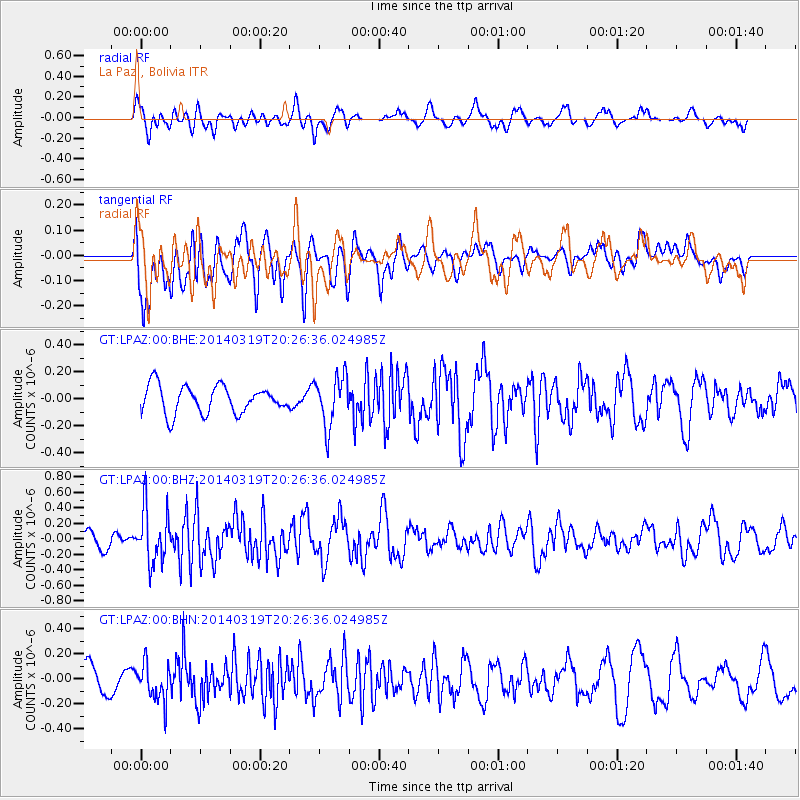
LPAZ La Paz , Bolivia - Earthquake Result Viewer
*The percent match for this event was below the threshold and hence no stack was calculated.
| Earthquake location: |
South Sandwich Islands Region |
| Earthquake latitude/longitude: |
-60.7/-25.3 |
| Earthquake time(UTC): |
2014/03/19 (078) 20:17:43 GMT |
| Earthquake Depth: |
10 km |
| Earthquake Magnitude: |
5.5 MWW, 5.4 MWB, 5.5 MWC |
| Earthquake Catalog/Contributor: |
NEIC PDE/NEIC COMCAT |
|
| Network: |
GT Global Telemetered Seismograph Network (USAF/USGS) |
| Station: |
LPAZ La Paz , Bolivia |
| Lat/Lon: |
16.17 S/68.08 W |
| Elevation: |
4817 m |
|
| Distance: |
54.0 deg |
| Az: |
306.265 deg |
| Baz: |
155.648 deg |
| Ray Param: |
$rayparam |
*The percent match for this event was below the threshold and hence was not used in the summary stack. |
|
| Radial Match: |
57.107887 % |
| Radial Bump: |
400 |
| Transverse Match: |
45.52114 % |
| Transverse Bump: |
400 |
| SOD ConfigId: |
626651 |
| Insert Time: |
2014-04-21 09:34:12.262 +0000 |
| GWidth: |
2.5 |
| Max Bumps: |
400 |
| Tol: |
0.001 |
|
Signal To Noise
| Channel | StoN | STA | LTA |
| GT:LPAZ:00:BHZ:20140319T20:26:36.024985Z | 2.8706198 | 3.4872465E-7 | 1.2148061E-7 |
| GT:LPAZ:00:BHN:20140319T20:26:36.024985Z | 1.4721463 | 1.4837565E-7 | 1.0078866E-7 |
| GT:LPAZ:00:BHE:20140319T20:26:36.024985Z | 1.7956219 | 1.8084332E-7 | 1.0071348E-7 |
| Arrivals |
| Ps | |
| PpPs | |
| PsPs/PpSs | |


