You are here: Home > Network List > CN - Canadian National Seismograph Network Stations List
> Station INK INUVIK, NT > Earthquake Result Viewer
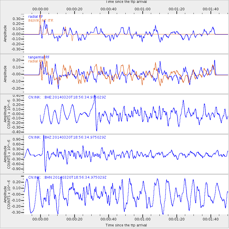
INK INUVIK, NT - Earthquake Result Viewer
*The percent match for this event was below the threshold and hence no stack was calculated.
| Earthquake location: |
New Britain Region, P.N.G. |
| Earthquake latitude/longitude: |
-5.2/152.8 |
| Earthquake time(UTC): |
2014/03/20 (079) 18:44:14 GMT |
| Earthquake Depth: |
26 km |
| Earthquake Magnitude: |
5.6 MWW, 5.6 MWC |
| Earthquake Catalog/Contributor: |
NEIC PDE/NEIC COMCAT |
|
| Network: |
CN Canadian National Seismograph Network |
| Station: |
INK INUVIK, NT |
| Lat/Lon: |
68.31 N/133.53 W |
| Elevation: |
44 m |
|
| Distance: |
88.9 deg |
| Az: |
20.909 deg |
| Baz: |
252.931 deg |
| Ray Param: |
$rayparam |
*The percent match for this event was below the threshold and hence was not used in the summary stack. |
|
| Radial Match: |
53.909813 % |
| Radial Bump: |
400 |
| Transverse Match: |
64.89392 % |
| Transverse Bump: |
400 |
| SOD ConfigId: |
626651 |
| Insert Time: |
2014-04-21 09:42:42.545 +0000 |
| GWidth: |
2.5 |
| Max Bumps: |
400 |
| Tol: |
0.001 |
|
Signal To Noise
| Channel | StoN | STA | LTA |
| CN:INK: :BHZ:20140320T18:56:34.975029Z | 2.2982063 | 4.931811E-7 | 2.1459391E-7 |
| CN:INK: :BHN:20140320T18:56:34.975029Z | 0.8159325 | 1.2204406E-7 | 1.4957617E-7 |
| CN:INK: :BHE:20140320T18:56:34.975029Z | 1.689222 | 2.1558749E-7 | 1.2762531E-7 |
| Arrivals |
| Ps | |
| PpPs | |
| PsPs/PpSs | |


