
ATD Arta Cave - Arta, Republic of Djibouti - Earthquake Result Viewer
| ||||||||||||||||||
| ||||||||||||||||||
| ||||||||||||||||||
|
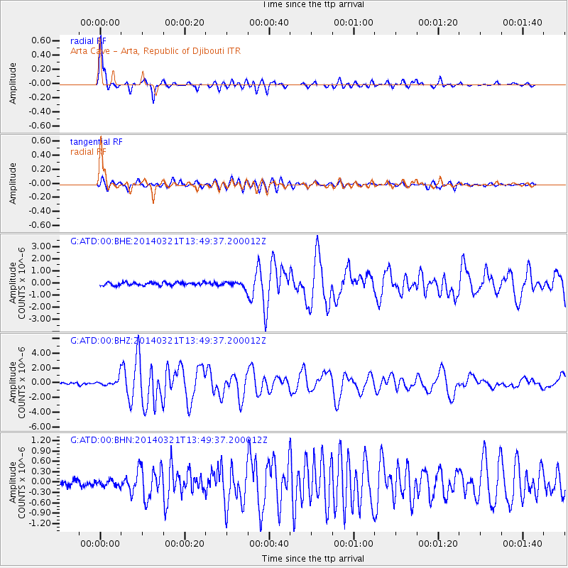
Signal To Noise
| Channel | StoN | STA | LTA |
| G:ATD:00:BHZ:20140321T13:49:37.200012Z | 5.360523 | 5.8069463E-7 | 1.08327974E-7 |
| G:ATD:00:BHN:20140321T13:49:37.200012Z | 0.9483294 | 8.748048E-8 | 9.2246935E-8 |
| G:ATD:00:BHE:20140321T13:49:37.200012Z | 1.9802221 | 2.4587092E-7 | 1.2416331E-7 |
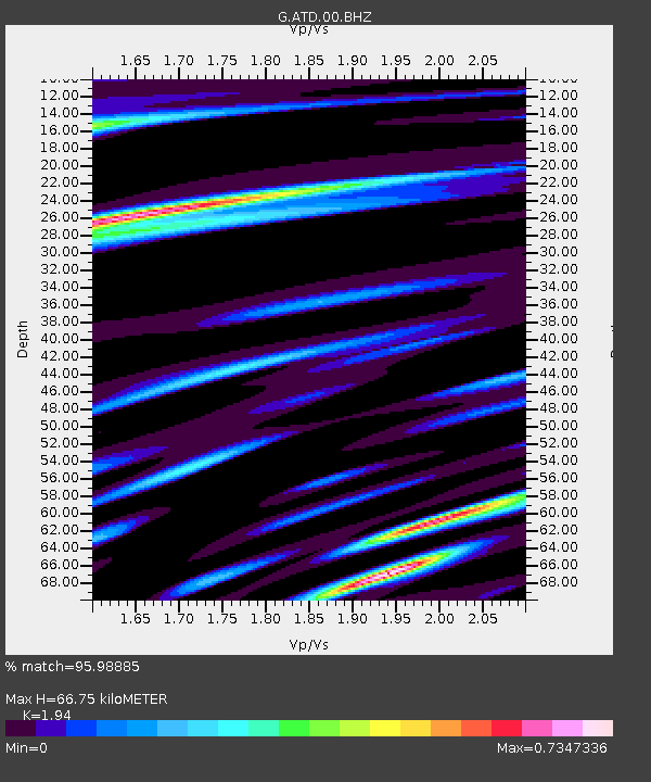
| Arrivals | |
| Ps | 10 SECOND |
| PpPs | 29 SECOND |
| PsPs/PpSs | 40 SECOND |

