You are here: Home > Network List > TA - USArray Transportable Network (new EarthScope stations) Stations List
> Station P56A Dayton Farm, Ripley, WV, USA > Earthquake Result Viewer
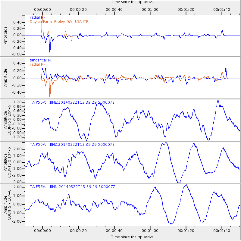
P56A Dayton Farm, Ripley, WV, USA - Earthquake Result Viewer
*The percent match for this event was below the threshold and hence no stack was calculated.
| Earthquake location: |
Near Coast Of Northern Chile |
| Earthquake latitude/longitude: |
-19.8/-71.0 |
| Earthquake time(UTC): |
2014/03/22 (081) 13:29:57 GMT |
| Earthquake Depth: |
10 km |
| Earthquake Magnitude: |
5.5 MB, 5.4 MWR, 5.6 MWW, 5.6 MWC |
| Earthquake Catalog/Contributor: |
NEIC PDE/NEIC COMCAT |
|
| Network: |
TA USArray Transportable Network (new EarthScope stations) |
| Station: |
P56A Dayton Farm, Ripley, WV, USA |
| Lat/Lon: |
39.50 N/78.84 W |
| Elevation: |
249 m |
|
| Distance: |
59.4 deg |
| Az: |
352.936 deg |
| Baz: |
171.39 deg |
| Ray Param: |
$rayparam |
*The percent match for this event was below the threshold and hence was not used in the summary stack. |
|
| Radial Match: |
86.94563 % |
| Radial Bump: |
345 |
| Transverse Match: |
61.506012 % |
| Transverse Bump: |
400 |
| SOD ConfigId: |
626651 |
| Insert Time: |
2014-04-21 11:07:23.404 +0000 |
| GWidth: |
2.5 |
| Max Bumps: |
400 |
| Tol: |
0.001 |
|
Signal To Noise
| Channel | StoN | STA | LTA |
| TA:P56A: :BHZ:20140322T13:39:29.500007Z | 2.1925151 | 1.0933601E-6 | 4.9867845E-7 |
| TA:P56A: :BHN:20140322T13:39:29.500007Z | 0.66995585 | 3.028546E-7 | 4.5205158E-7 |
| TA:P56A: :BHE:20140322T13:39:29.500007Z | 1.8511425 | 1.1737294E-6 | 6.3405673E-7 |
| Arrivals |
| Ps | |
| PpPs | |
| PsPs/PpSs | |


