You are here: Home > Network List > TA - USArray Transportable Network (new EarthScope stations) Stations List
> Station X43A Marvell, AR, USA > Earthquake Result Viewer
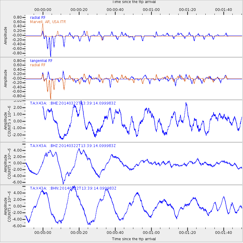
X43A Marvell, AR, USA - Earthquake Result Viewer
*The percent match for this event was below the threshold and hence no stack was calculated.
| Earthquake location: |
Near Coast Of Northern Chile |
| Earthquake latitude/longitude: |
-19.8/-71.0 |
| Earthquake time(UTC): |
2014/03/22 (081) 13:29:57 GMT |
| Earthquake Depth: |
10 km |
| Earthquake Magnitude: |
5.5 MB, 5.4 MWR, 5.6 MWW, 5.6 MWC |
| Earthquake Catalog/Contributor: |
NEIC PDE/NEIC COMCAT |
|
| Network: |
TA USArray Transportable Network (new EarthScope stations) |
| Station: |
X43A Marvell, AR, USA |
| Lat/Lon: |
34.52 N/90.88 W |
| Elevation: |
53 m |
|
| Distance: |
57.2 deg |
| Az: |
340.461 deg |
| Baz: |
157.576 deg |
| Ray Param: |
$rayparam |
*The percent match for this event was below the threshold and hence was not used in the summary stack. |
|
| Radial Match: |
94.002495 % |
| Radial Bump: |
400 |
| Transverse Match: |
75.06232 % |
| Transverse Bump: |
400 |
| SOD ConfigId: |
626651 |
| Insert Time: |
2014-04-21 11:09:00.938 +0000 |
| GWidth: |
2.5 |
| Max Bumps: |
400 |
| Tol: |
0.001 |
|
Signal To Noise
| Channel | StoN | STA | LTA |
| TA:X43A: :BHZ:20140322T13:39:14.099983Z | 1.3814814 | 2.7236574E-6 | 1.9715485E-6 |
| TA:X43A: :BHN:20140322T13:39:14.099983Z | 1.7349424 | 3.914691E-6 | 2.256381E-6 |
| TA:X43A: :BHE:20140322T13:39:14.099983Z | 0.8643115 | 1.3499181E-6 | 1.561842E-6 |
| Arrivals |
| Ps | |
| PpPs | |
| PsPs/PpSs | |


