You are here: Home > Network List > TA - USArray Transportable Network (new EarthScope stations) Stations List
> Station R11A Troy Canyon, Currant, NV, USA > Earthquake Result Viewer
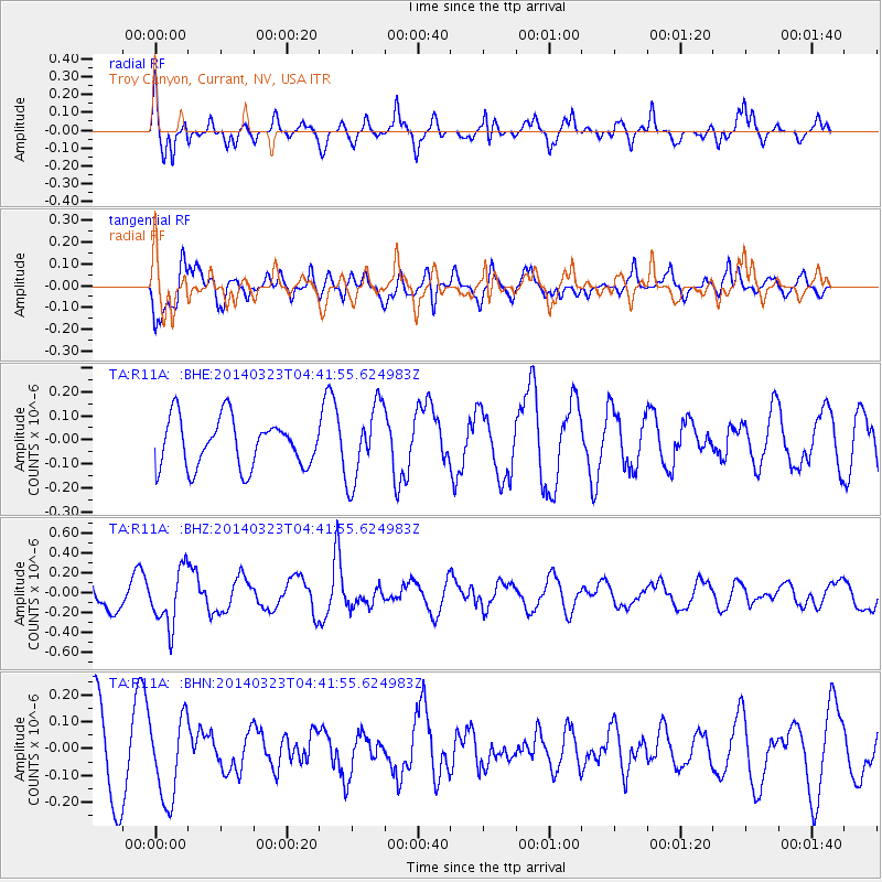
R11A Troy Canyon, Currant, NV, USA - Earthquake Result Viewer
*The percent match for this event was below the threshold and hence no stack was calculated.
| Earthquake location: |
Fiji Islands Region |
| Earthquake latitude/longitude: |
-20.7/-178.8 |
| Earthquake time(UTC): |
2014/03/23 (082) 04:31:02 GMT |
| Earthquake Depth: |
607 km |
| Earthquake Magnitude: |
5.7 MWP, 5.9 MWC, 5.9 MWB |
| Earthquake Catalog/Contributor: |
NEIC PDE/NEIC COMCAT |
|
| Network: |
TA USArray Transportable Network (new EarthScope stations) |
| Station: |
R11A Troy Canyon, Currant, NV, USA |
| Lat/Lon: |
38.35 N/115.59 W |
| Elevation: |
1756 m |
|
| Distance: |
83.4 deg |
| Az: |
44.97 deg |
| Baz: |
237.328 deg |
| Ray Param: |
$rayparam |
*The percent match for this event was below the threshold and hence was not used in the summary stack. |
|
| Radial Match: |
77.520805 % |
| Radial Bump: |
387 |
| Transverse Match: |
76.58793 % |
| Transverse Bump: |
400 |
| SOD ConfigId: |
626651 |
| Insert Time: |
2014-04-21 11:31:23.608 +0000 |
| GWidth: |
2.5 |
| Max Bumps: |
400 |
| Tol: |
0.001 |
|
Signal To Noise
| Channel | StoN | STA | LTA |
| TA:R11A: :BHZ:20140323T04:41:55.624983Z | 1.4232804 | 2.8195848E-7 | 1.9810466E-7 |
| TA:R11A: :BHN:20140323T04:41:55.624983Z | 0.9893865 | 1.5162931E-7 | 1.5325588E-7 |
| TA:R11A: :BHE:20140323T04:41:55.624983Z | 1.5696942 | 1.5802516E-7 | 1.0067258E-7 |
| Arrivals |
| Ps | |
| PpPs | |
| PsPs/PpSs | |


