You are here: Home > Network List > US - United States National Seismic Network Stations List
> Station AMTX Amarillo, Texas, USA > Earthquake Result Viewer
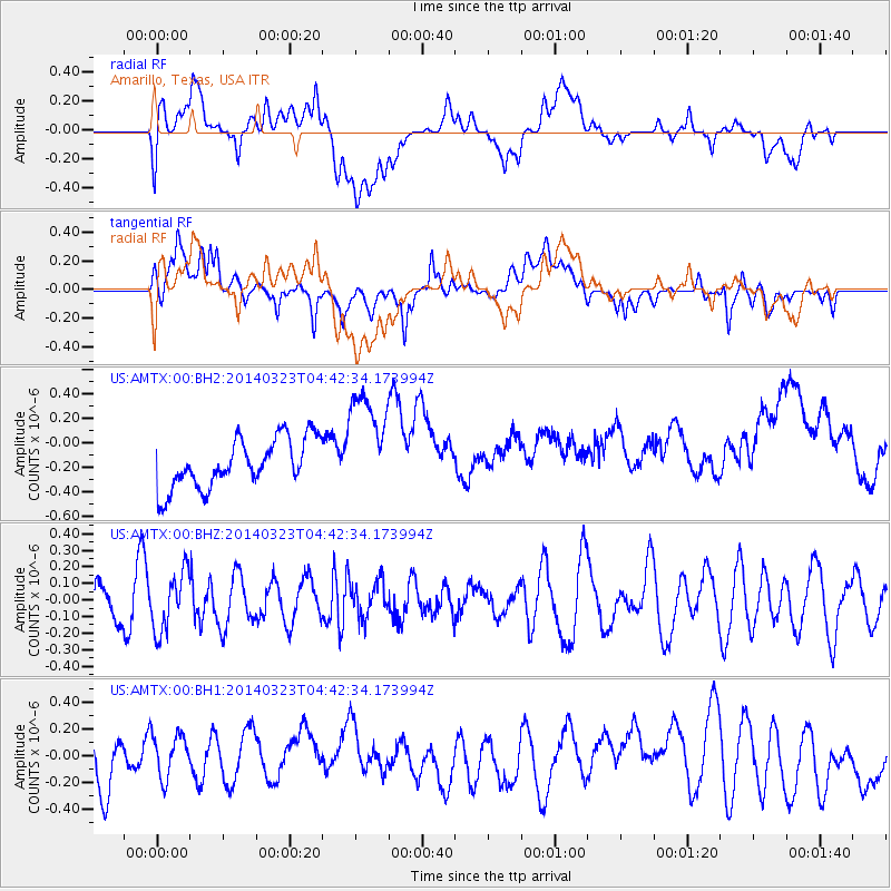
AMTX Amarillo, Texas, USA - Earthquake Result Viewer
*The percent match for this event was below the threshold and hence no stack was calculated.
| Earthquake location: |
Fiji Islands Region |
| Earthquake latitude/longitude: |
-20.7/-178.8 |
| Earthquake time(UTC): |
2014/03/23 (082) 04:31:02 GMT |
| Earthquake Depth: |
607 km |
| Earthquake Magnitude: |
5.7 MWP, 5.9 MWC, 5.9 MWB |
| Earthquake Catalog/Contributor: |
NEIC PDE/NEIC COMCAT |
|
| Network: |
US United States National Seismic Network |
| Station: |
AMTX Amarillo, Texas, USA |
| Lat/Lon: |
34.53 N/101.41 W |
| Elevation: |
1010 m |
|
| Distance: |
91.7 deg |
| Az: |
53.719 deg |
| Baz: |
246.121 deg |
| Ray Param: |
$rayparam |
*The percent match for this event was below the threshold and hence was not used in the summary stack. |
|
| Radial Match: |
30.325548 % |
| Radial Bump: |
400 |
| Transverse Match: |
38.11857 % |
| Transverse Bump: |
400 |
| SOD ConfigId: |
626651 |
| Insert Time: |
2014-04-21 11:31:56.995 +0000 |
| GWidth: |
2.5 |
| Max Bumps: |
400 |
| Tol: |
0.001 |
|
Signal To Noise
| Channel | StoN | STA | LTA |
| US:AMTX:00:BHZ:20140323T04:42:34.173994Z | 1.1619368 | 1.76809E-7 | 1.5216749E-7 |
| US:AMTX:00:BH1:20140323T04:42:34.173994Z | 1.099151 | 1.6752239E-7 | 1.524107E-7 |
| US:AMTX:00:BH2:20140323T04:42:34.173994Z | 2.2312803 | 4.4296857E-7 | 1.9852664E-7 |
| Arrivals |
| Ps | |
| PpPs | |
| PsPs/PpSs | |


