You are here: Home > Network List > TA - USArray Transportable Network (new EarthScope stations) Stations List
> Station Q24A Divide, CO, USA > Earthquake Result Viewer
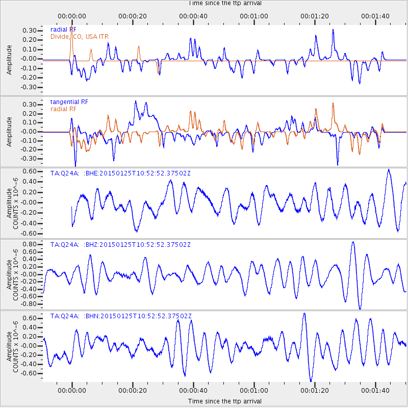
Q24A Divide, CO, USA - Earthquake Result Viewer
*The percent match for this event was below the threshold and hence no stack was calculated.
| Earthquake location: |
Southeast Of Honshu, Japan |
| Earthquake latitude/longitude: |
29.2/139.5 |
| Earthquake time(UTC): |
2015/01/25 (025) 10:41:14 GMT |
| Earthquake Depth: |
427 km |
| Earthquake Magnitude: |
5.3 MW, 4.9 mb |
| Earthquake Catalog/Contributor: |
ISC/ISC |
|
| Network: |
TA USArray Transportable Network (new EarthScope stations) |
| Station: |
Q24A Divide, CO, USA |
| Lat/Lon: |
38.96 N/105.15 W |
| Elevation: |
2775 m |
|
| Distance: |
89.3 deg |
| Az: |
44.78 deg |
| Baz: |
307.826 deg |
| Ray Param: |
$rayparam |
*The percent match for this event was below the threshold and hence was not used in the summary stack. |
|
| Radial Match: |
43.103348 % |
| Radial Bump: |
400 |
| Transverse Match: |
43.63595 % |
| Transverse Bump: |
400 |
| SOD ConfigId: |
3390531 |
| Insert Time: |
2019-04-16 04:05:40.566 +0000 |
| GWidth: |
2.5 |
| Max Bumps: |
400 |
| Tol: |
0.001 |
|
Signal To Noise
| Channel | StoN | STA | LTA |
| TA:Q24A: :BHZ:20150125T10:52:52.37502Z | 0.8166612 | 2.3182709E-7 | 2.838718E-7 |
| TA:Q24A: :BHN:20150125T10:52:52.37502Z | 1.1045777 | 2.435139E-7 | 2.2045884E-7 |
| TA:Q24A: :BHE:20150125T10:52:52.37502Z | 1.4599043 | 2.87762E-7 | 1.9711017E-7 |
| Arrivals |
| Ps | |
| PpPs | |
| PsPs/PpSs | |


