You are here: Home > Network List > TA - USArray Transportable Network (new EarthScope stations) Stations List
> Station MSTX Muleshoe, TX, USA > Earthquake Result Viewer
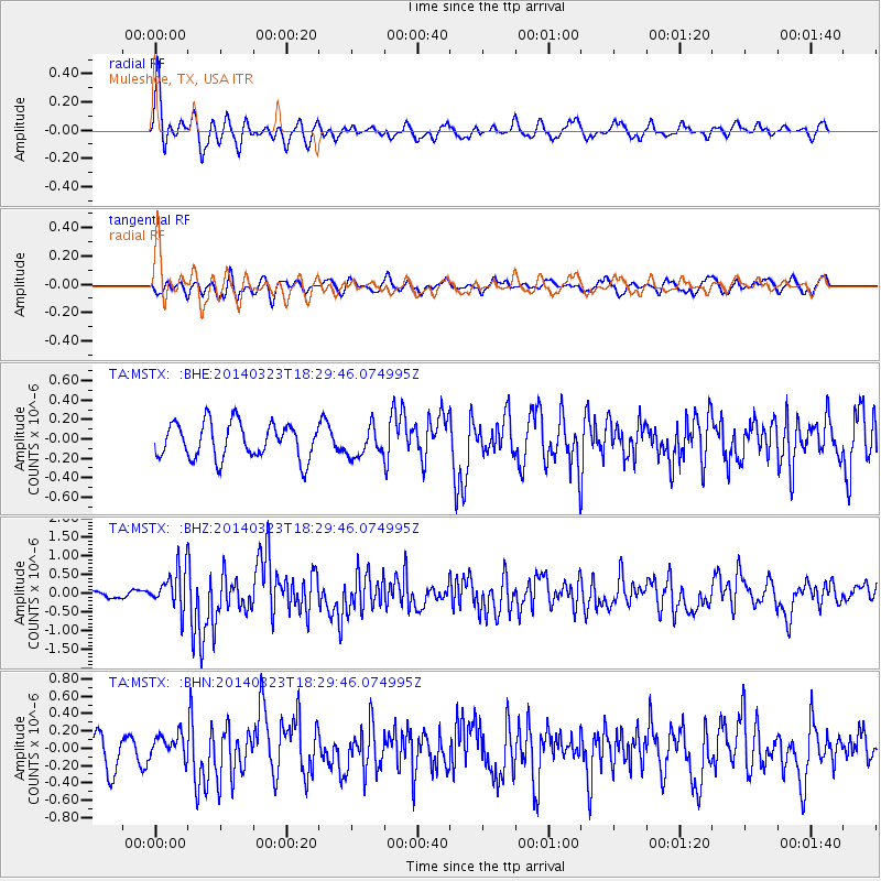
MSTX Muleshoe, TX, USA - Earthquake Result Viewer
*The percent match for this event was below the threshold and hence no stack was calculated.
| Earthquake location: |
Near Coast Of Northern Chile |
| Earthquake latitude/longitude: |
-19.7/-70.8 |
| Earthquake time(UTC): |
2014/03/23 (082) 18:20:03 GMT |
| Earthquake Depth: |
35 km |
| Earthquake Magnitude: |
6.0 MB, 6.2 MWB, 6.2 MWW, 6.3 MWC |
| Earthquake Catalog/Contributor: |
NEIC PDE/NEIC COMCAT |
|
| Network: |
TA USArray Transportable Network (new EarthScope stations) |
| Station: |
MSTX Muleshoe, TX, USA |
| Lat/Lon: |
33.97 N/102.77 W |
| Elevation: |
1167 m |
|
| Distance: |
61.5 deg |
| Az: |
329.957 deg |
| Baz: |
145.428 deg |
| Ray Param: |
$rayparam |
*The percent match for this event was below the threshold and hence was not used in the summary stack. |
|
| Radial Match: |
78.709 % |
| Radial Bump: |
400 |
| Transverse Match: |
50.77952 % |
| Transverse Bump: |
391 |
| SOD ConfigId: |
626651 |
| Insert Time: |
2014-04-21 12:04:13.043 +0000 |
| GWidth: |
2.5 |
| Max Bumps: |
400 |
| Tol: |
0.001 |
|
Signal To Noise
| Channel | StoN | STA | LTA |
| TA:MSTX: :BHZ:20140323T18:29:46.074995Z | 5.0378366 | 5.401138E-7 | 1.0721145E-7 |
| TA:MSTX: :BHN:20140323T18:29:46.074995Z | 0.9696713 | 1.5225673E-7 | 1.570189E-7 |
| TA:MSTX: :BHE:20140323T18:29:46.074995Z | 0.81826 | 1.4865026E-7 | 1.8166628E-7 |
| Arrivals |
| Ps | |
| PpPs | |
| PsPs/PpSs | |


