You are here: Home > Network List > GS - US Geological Survey Networks Stations List
> Station KAN10 Keim Farm > Earthquake Result Viewer
KAN10 Keim Farm - Earthquake Result Viewer
*The percent match for this event was below the threshold and hence no stack was calculated.
| Earthquake location: |
Tonga Islands |
| Earthquake latitude/longitude: |
-18.8/-174.6 |
| Earthquake time(UTC): |
2015/01/26 (026) 19:12:13 GMT |
| Earthquake Depth: |
90 km |
| Earthquake Magnitude: |
5.3 MW, 5.2 mb |
| Earthquake Catalog/Contributor: |
ISC/ISC |
|
| Network: |
GS US Geological Survey Networks |
| Station: |
KAN10 Keim Farm |
| Lat/Lon: |
37.12 N/98.10 W |
| Elevation: |
417 m |
|
| Distance: |
90.9 deg |
| Az: |
51.018 deg |
| Baz: |
247.092 deg |
| Ray Param: |
$rayparam |
*The percent match for this event was below the threshold and hence was not used in the summary stack. |
|
| Radial Match: |
63.52374 % |
| Radial Bump: |
400 |
| Transverse Match: |
42.34603 % |
| Transverse Bump: |
400 |
| SOD ConfigId: |
3390531 |
| Insert Time: |
2019-04-16 04:21:19.495 +0000 |
| GWidth: |
2.5 |
| Max Bumps: |
400 |
| Tol: |
0.001 |
|
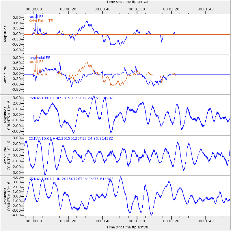
Signal To Noise
| Channel | StoN | STA | LTA |
| GS:KAN10:01:HHZ:20150126T19:24:35.81498Z | 2.1841824 | 1.8105416E-6 | 8.289333E-7 |
| GS:KAN10:01:HHN:20150126T19:24:35.81498Z | 1.432513 | 2.2137863E-6 | 1.5453865E-6 |
| GS:KAN10:01:HHE:20150126T19:24:35.81498Z | 1.2779577 | 1.8177603E-6 | 1.4223948E-6 |
| Arrivals |
| Ps | |
| PpPs | |
| PsPs/PpSs | |


