You are here: Home > Network List > IU - Global Seismograph Network (GSN - IRIS/USGS) Stations List
> Station PMG Port Moresby, New Guinea > Earthquake Result Viewer
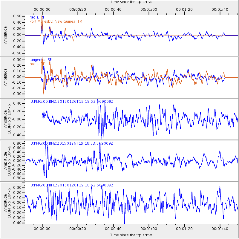
PMG Port Moresby, New Guinea - Earthquake Result Viewer
*The percent match for this event was below the threshold and hence no stack was calculated.
| Earthquake location: |
Tonga Islands |
| Earthquake latitude/longitude: |
-18.8/-174.6 |
| Earthquake time(UTC): |
2015/01/26 (026) 19:12:13 GMT |
| Earthquake Depth: |
90 km |
| Earthquake Magnitude: |
5.3 MW, 5.2 mb |
| Earthquake Catalog/Contributor: |
ISC/ISC |
|
| Network: |
IU Global Seismograph Network (GSN - IRIS/USGS) |
| Station: |
PMG Port Moresby, New Guinea |
| Lat/Lon: |
9.40 S/147.16 E |
| Elevation: |
90 m |
|
| Distance: |
38.2 deg |
| Az: |
278.838 deg |
| Baz: |
108.475 deg |
| Ray Param: |
$rayparam |
*The percent match for this event was below the threshold and hence was not used in the summary stack. |
|
| Radial Match: |
59.671352 % |
| Radial Bump: |
400 |
| Transverse Match: |
57.261623 % |
| Transverse Bump: |
400 |
| SOD ConfigId: |
3390531 |
| Insert Time: |
2019-04-16 04:21:39.435 +0000 |
| GWidth: |
2.5 |
| Max Bumps: |
400 |
| Tol: |
0.001 |
|
Signal To Noise
| Channel | StoN | STA | LTA |
| IU:PMG:00:BHZ:20150126T19:18:53.569009Z | 3.5245345 | 3.880365E-7 | 1.10095826E-7 |
| IU:PMG:00:BH1:20150126T19:18:53.569009Z | 1.7518514 | 1.7066533E-7 | 9.7419985E-8 |
| IU:PMG:00:BH2:20150126T19:18:53.569009Z | 3.2123396 | 2.7141368E-7 | 8.449097E-8 |
| Arrivals |
| Ps | |
| PpPs | |
| PsPs/PpSs | |


