You are here: Home > Network List > TA - USArray Transportable Network (new EarthScope stations) Stations List
> Station Q24A Divide, CO, USA > Earthquake Result Viewer
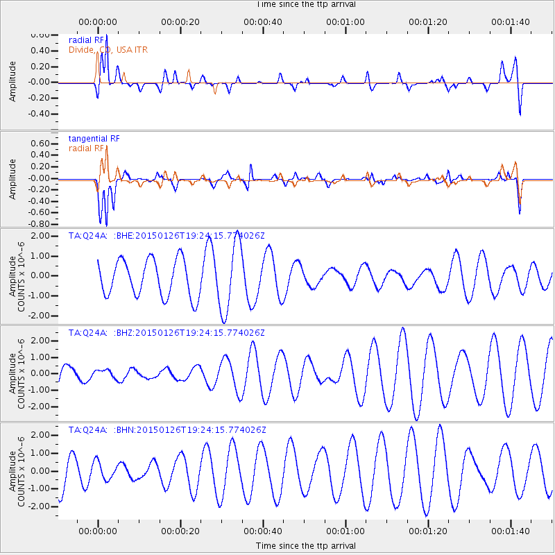
Q24A Divide, CO, USA - Earthquake Result Viewer
*The percent match for this event was below the threshold and hence no stack was calculated.
| Earthquake location: |
Tonga Islands |
| Earthquake latitude/longitude: |
-18.8/-174.6 |
| Earthquake time(UTC): |
2015/01/26 (026) 19:12:13 GMT |
| Earthquake Depth: |
90 km |
| Earthquake Magnitude: |
5.3 MW, 5.2 mb |
| Earthquake Catalog/Contributor: |
ISC/ISC |
|
| Network: |
TA USArray Transportable Network (new EarthScope stations) |
| Station: |
Q24A Divide, CO, USA |
| Lat/Lon: |
38.96 N/105.15 W |
| Elevation: |
2775 m |
|
| Distance: |
86.7 deg |
| Az: |
46.993 deg |
| Baz: |
242.675 deg |
| Ray Param: |
$rayparam |
*The percent match for this event was below the threshold and hence was not used in the summary stack. |
|
| Radial Match: |
70.92077 % |
| Radial Bump: |
400 |
| Transverse Match: |
66.689354 % |
| Transverse Bump: |
400 |
| SOD ConfigId: |
3390531 |
| Insert Time: |
2019-04-16 04:24:02.802 +0000 |
| GWidth: |
2.5 |
| Max Bumps: |
400 |
| Tol: |
0.001 |
|
Signal To Noise
| Channel | StoN | STA | LTA |
| TA:Q24A: :BHZ:20150126T19:24:15.774026Z | 0.35174707 | 2.620187E-7 | 7.449066E-7 |
| TA:Q24A: :BHN:20150126T19:24:15.774026Z | 0.53445387 | 4.981667E-7 | 9.321042E-7 |
| TA:Q24A: :BHE:20150126T19:24:15.774026Z | 1.9312053 | 1.7521539E-6 | 9.072852E-7 |
| Arrivals |
| Ps | |
| PpPs | |
| PsPs/PpSs | |


