You are here: Home > Network List > KN - Kyrgyz Seismic Telemetry Network Stations List
> Station TKM2 - > Earthquake Result Viewer
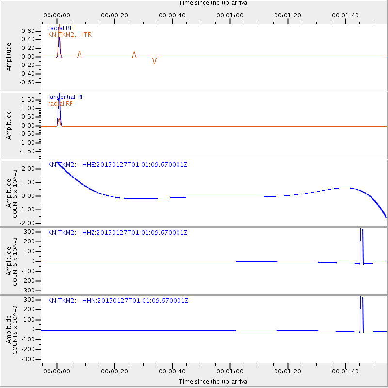
TKM2 - - Earthquake Result Viewer
*The percent match for this event was below the threshold and hence no stack was calculated.
| Earthquake location: |
Northern Sumatra, Indonesia |
| Earthquake latitude/longitude: |
1.4/97.2 |
| Earthquake time(UTC): |
2015/01/27 (027) 00:53:19 GMT |
| Earthquake Depth: |
13 km |
| Earthquake Magnitude: |
5.6 MB, 5.7 MWB |
| Earthquake Catalog/Contributor: |
NEIC PDE/NEIC COMCAT |
|
| Network: |
KN Kyrgyz Seismic Telemetry Network |
| Station: |
TKM2 - |
| Lat/Lon: |
42.92 N/75.60 E |
| Elevation: |
2020 m |
|
| Distance: |
45.7 deg |
| Az: |
337.759 deg |
| Baz: |
148.994 deg |
| Ray Param: |
$rayparam |
*The percent match for this event was below the threshold and hence was not used in the summary stack. |
|
| Radial Match: |
100.0 % |
| Radial Bump: |
2 |
| Transverse Match: |
100.0 % |
| Transverse Bump: |
2 |
| SOD ConfigId: |
3390531 |
| Insert Time: |
2019-04-16 04:29:25.047 +0000 |
| GWidth: |
2.5 |
| Max Bumps: |
400 |
| Tol: |
0.001 |
|
Signal To Noise
| Channel | StoN | STA | LTA |
| KN:TKM2: :HHZ:20150127T01:01:09.670001Z | 1.1457669 | 9.177419E-4 | 8.009849E-4 |
| KN:TKM2: :HHN:20150127T01:01:09.670001Z | 1.1459852 | 9.179406E-4 | 8.010056E-4 |
| KN:TKM2: :HHE:20150127T01:01:09.670001Z | 1.1460786 | 9.179808E-4 | 8.009754E-4 |
| Arrivals |
| Ps | |
| PpPs | |
| PsPs/PpSs | |


