You are here: Home > Network List > TA - USArray Transportable Network (new EarthScope stations) Stations List
> Station A21K Barrow, AK, USA > Earthquake Result Viewer
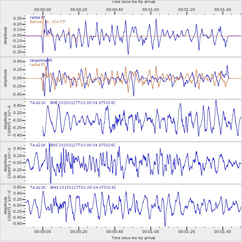
A21K Barrow, AK, USA - Earthquake Result Viewer
*The percent match for this event was below the threshold and hence no stack was calculated.
| Earthquake location: |
Northern Sumatra, Indonesia |
| Earthquake latitude/longitude: |
1.4/97.2 |
| Earthquake time(UTC): |
2015/01/27 (027) 00:53:19 GMT |
| Earthquake Depth: |
13 km |
| Earthquake Magnitude: |
5.6 MB, 5.7 MWB |
| Earthquake Catalog/Contributor: |
NEIC PDE/NEIC COMCAT |
|
| Network: |
TA USArray Transportable Network (new EarthScope stations) |
| Station: |
A21K Barrow, AK, USA |
| Lat/Lon: |
71.32 N/156.62 W |
| Elevation: |
577 m |
|
| Distance: |
93.8 deg |
| Az: |
18.068 deg |
| Baz: |
285.766 deg |
| Ray Param: |
$rayparam |
*The percent match for this event was below the threshold and hence was not used in the summary stack. |
|
| Radial Match: |
52.94829 % |
| Radial Bump: |
400 |
| Transverse Match: |
59.81169 % |
| Transverse Bump: |
347 |
| SOD ConfigId: |
3390531 |
| Insert Time: |
2019-04-16 04:30:14.493 +0000 |
| GWidth: |
2.5 |
| Max Bumps: |
400 |
| Tol: |
0.001 |
|
Signal To Noise
| Channel | StoN | STA | LTA |
| TA:A21K: :BHZ:20150127T01:06:04.975024Z | 2.077792 | 2.633629E-7 | 1.2675133E-7 |
| TA:A21K: :BHN:20150127T01:06:04.975024Z | 1.4222472 | 2.0857004E-7 | 1.4664823E-7 |
| TA:A21K: :BHE:20150127T01:06:04.975024Z | 0.8037757 | 1.5797298E-7 | 1.9653862E-7 |
| Arrivals |
| Ps | |
| PpPs | |
| PsPs/PpSs | |


