You are here: Home > Network List > TA - USArray Transportable Network (new EarthScope stations) Stations List
> Station G59A Clarenceville, QC, USA > Earthquake Result Viewer
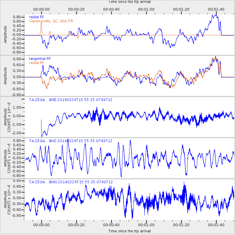
G59A Clarenceville, QC, USA - Earthquake Result Viewer
*The percent match for this event was below the threshold and hence no stack was calculated.
| Earthquake location: |
Near Coast Of Northern Chile |
| Earthquake latitude/longitude: |
-19.6/-70.8 |
| Earthquake time(UTC): |
2014/03/24 (083) 15:45:31 GMT |
| Earthquake Depth: |
18 km |
| Earthquake Magnitude: |
5.6 MWB, 5.5 MWR, 5.7 MWC, 5.7 MWW |
| Earthquake Catalog/Contributor: |
NEIC PDE/NEIC COMCAT |
|
| Network: |
TA USArray Transportable Network (new EarthScope stations) |
| Station: |
G59A Clarenceville, QC, USA |
| Lat/Lon: |
45.08 N/73.18 W |
| Elevation: |
36 m |
|
| Distance: |
64.4 deg |
| Az: |
358.143 deg |
| Baz: |
177.528 deg |
| Ray Param: |
$rayparam |
*The percent match for this event was below the threshold and hence was not used in the summary stack. |
|
| Radial Match: |
29.901075 % |
| Radial Bump: |
400 |
| Transverse Match: |
28.347277 % |
| Transverse Bump: |
400 |
| SOD ConfigId: |
626651 |
| Insert Time: |
2014-04-21 13:21:02.666 +0000 |
| GWidth: |
2.5 |
| Max Bumps: |
400 |
| Tol: |
0.001 |
|
Signal To Noise
| Channel | StoN | STA | LTA |
| TA:G59A: :BHZ:20140324T15:55:35.074971Z | 0.9833061 | 3.0797406E-7 | 3.1320263E-7 |
| TA:G59A: :BHN:20140324T15:55:35.074971Z | 0.9080302 | 6.7581925E-7 | 7.442695E-7 |
| TA:G59A: :BHE:20140324T15:55:35.074971Z | 0.8748892 | 6.879216E-7 | 7.8629574E-7 |
| Arrivals |
| Ps | |
| PpPs | |
| PsPs/PpSs | |


