HUMO Hull Mountain, OR - Earthquake Result Viewer
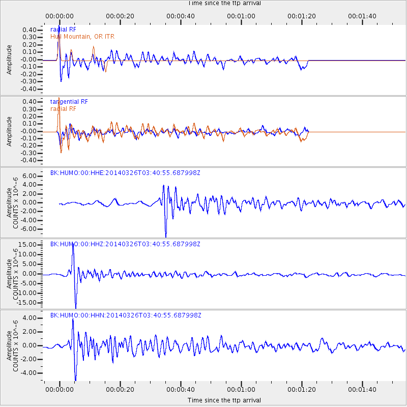
Earthquake location: South Of Fiji Islands
Earthquake latitude/longitude: -26.1/179.3
Earthquake time(UTC): 2014/03/26 (085) 03:29:36 GMT
Earthquake Depth: 493 km
Earthquake Magnitude: 6.5 MWP, 6.3 MWW, 6.3 MWC, 6.4 MWB, 6.4 MWC, 6.5 MI
Earthquake Catalog/Contributor: NEIC PDE/NEIC COMCAT
Network: BK Berkeley Digital Seismograph Network
Station: HUMO Hull Mountain, OR
Lat/Lon: 42.61 N/122.96 W
Elevation: 555 m
Distance: 86.6 deg
Az: 38.724 deg
Baz: 229.639 deg
Ray Param: 0.04256695
Estimated Moho Depth: 43.25 km
Estimated Crust Vp/Vs: 1.92
Assumed Crust Vp: 6.522 km/s
Estimated Crust Vs: 3.397 km/s
Estimated Crust Poisson's Ratio: 0.31
Radial Match: 90.80606 %
Radial Bump: 400
Transverse Match: 71.19401 %
Transverse Bump: 400
SOD ConfigId: 626651
Insert Time: 2014-04-21 13:39:56.578 +0000
GWidth: 2.5
Max Bumps: 400
Tol: 0.001

Signal To Noise

ChannelStoNSTALTA
BK:HUMO:00:HHZ:20140326T03:40:55.687998Z13.6372644.6516134E-63.4109578E-7
BK:HUMO:00:HHN:20140326T03:40:55.687998Z3.62824541.106304E-63.0491435E-7
BK:HUMO:00:HHE:20140326T03:40:55.687998Z3.5946851.2351331E-63.4359982E-7
Arrivals
Ps6.2 SECOND
PpPs19 SECOND
PsPs/PpSs25 SECOND