You are here: Home > Network List > TA - USArray Transportable Network (new EarthScope stations) Stations List
> Station J01E Myrtle Point, OR, USA > Earthquake Result Viewer
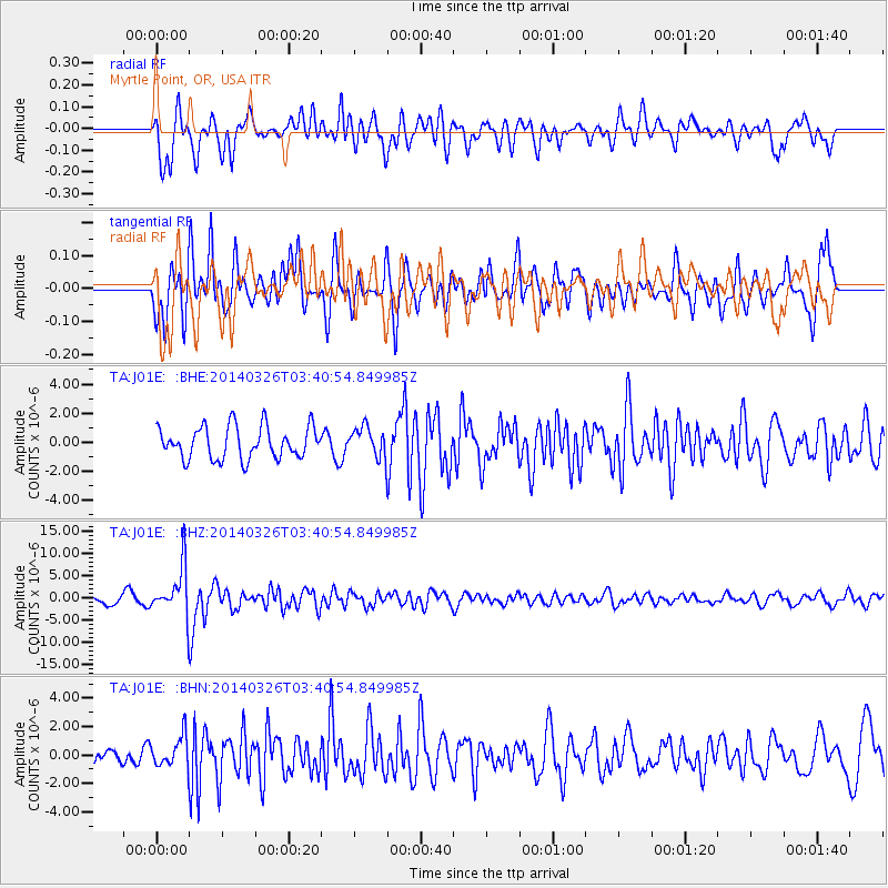
J01E Myrtle Point, OR, USA - Earthquake Result Viewer
*The percent match for this event was below the threshold and hence no stack was calculated.
| Earthquake location: |
South Of Fiji Islands |
| Earthquake latitude/longitude: |
-26.1/179.3 |
| Earthquake time(UTC): |
2014/03/26 (085) 03:29:36 GMT |
| Earthquake Depth: |
493 km |
| Earthquake Magnitude: |
6.5 MWP, 6.3 MWW, 6.3 MWC, 6.4 MWB, 6.4 MWC, 6.5 MI |
| Earthquake Catalog/Contributor: |
NEIC PDE/NEIC COMCAT |
|
| Network: |
TA USArray Transportable Network (new EarthScope stations) |
| Station: |
J01E Myrtle Point, OR, USA |
| Lat/Lon: |
43.16 N/123.93 W |
| Elevation: |
128 m |
|
| Distance: |
86.4 deg |
| Az: |
37.835 deg |
| Baz: |
228.924 deg |
| Ray Param: |
$rayparam |
*The percent match for this event was below the threshold and hence was not used in the summary stack. |
|
| Radial Match: |
74.27655 % |
| Radial Bump: |
400 |
| Transverse Match: |
71.65346 % |
| Transverse Bump: |
400 |
| SOD ConfigId: |
626651 |
| Insert Time: |
2014-04-21 13:51:09.173 +0000 |
| GWidth: |
2.5 |
| Max Bumps: |
400 |
| Tol: |
0.001 |
|
Signal To Noise
| Channel | StoN | STA | LTA |
| TA:J01E: :BHZ:20140326T03:40:54.849985Z | 4.8129168 | 5.4558745E-6 | 1.13359E-6 |
| TA:J01E: :BHN:20140326T03:40:54.849985Z | 1.5654391 | 1.0729729E-6 | 6.8541334E-7 |
| TA:J01E: :BHE:20140326T03:40:54.849985Z | 0.9325147 | 1.027216E-6 | 1.1015546E-6 |
| Arrivals |
| Ps | |
| PpPs | |
| PsPs/PpSs | |


