You are here: Home > Network List > US - United States National Seismic Network Stations List
> Station AMTX Amarillo, Texas, USA > Earthquake Result Viewer
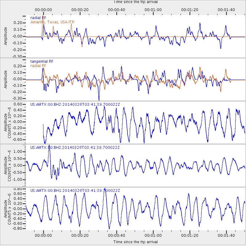
AMTX Amarillo, Texas, USA - Earthquake Result Viewer
*The percent match for this event was below the threshold and hence no stack was calculated.
| Earthquake location: |
South Of Fiji Islands |
| Earthquake latitude/longitude: |
-26.1/179.3 |
| Earthquake time(UTC): |
2014/03/26 (085) 03:29:36 GMT |
| Earthquake Depth: |
493 km |
| Earthquake Magnitude: |
6.5 MWP, 6.3 MWW, 6.3 MWC, 6.4 MWB, 6.4 MWC, 6.5 MI |
| Earthquake Catalog/Contributor: |
NEIC PDE/NEIC COMCAT |
|
| Network: |
US United States National Seismic Network |
| Station: |
AMTX Amarillo, Texas, USA |
| Lat/Lon: |
34.53 N/101.41 W |
| Elevation: |
1010 m |
|
| Distance: |
96.3 deg |
| Az: |
54.702 deg |
| Baz: |
242.744 deg |
| Ray Param: |
$rayparam |
*The percent match for this event was below the threshold and hence was not used in the summary stack. |
|
| Radial Match: |
54.162952 % |
| Radial Bump: |
400 |
| Transverse Match: |
58.971397 % |
| Transverse Bump: |
346 |
| SOD ConfigId: |
626651 |
| Insert Time: |
2014-04-21 13:52:34.482 +0000 |
| GWidth: |
2.5 |
| Max Bumps: |
400 |
| Tol: |
0.001 |
|
Signal To Noise
| Channel | StoN | STA | LTA |
| US:AMTX:00:BHZ:20140326T03:41:39.700022Z | 2.0265765 | 6.3674133E-7 | 3.1419555E-7 |
| US:AMTX:00:BH1:20140326T03:41:39.700022Z | 1.5580554 | 3.7105545E-7 | 2.3815292E-7 |
| US:AMTX:00:BH2:20140326T03:41:39.700022Z | 1.0710835 | 2.9024287E-7 | 2.7098062E-7 |
| Arrivals |
| Ps | |
| PpPs | |
| PsPs/PpSs | |


