You are here: Home > Network List > CI - Caltech Regional Seismic Network Stations List
> Station DAN Danby, California, USA > Earthquake Result Viewer
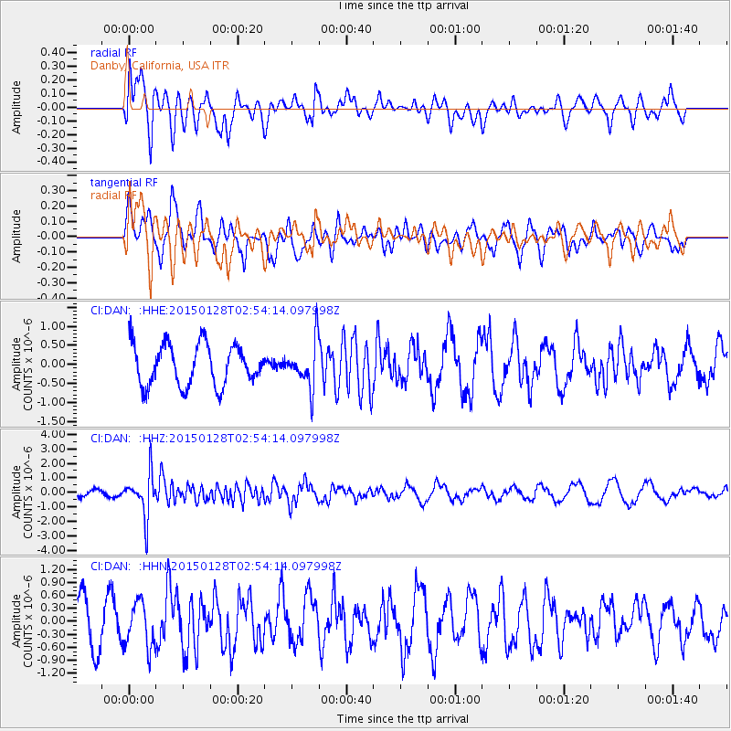
DAN Danby, California, USA - Earthquake Result Viewer
*The percent match for this event was below the threshold and hence no stack was calculated.
| Earthquake location: |
Fiji Islands Region |
| Earthquake latitude/longitude: |
-20.9/-178.4 |
| Earthquake time(UTC): |
2015/01/28 (028) 02:43:19 GMT |
| Earthquake Depth: |
484 km |
| Earthquake Magnitude: |
6.1 MWP |
| Earthquake Catalog/Contributor: |
NEIC PDE/NEIC COMCAT |
|
| Network: |
CI Caltech Regional Seismic Network |
| Station: |
DAN Danby, California, USA |
| Lat/Lon: |
34.64 N/115.38 W |
| Elevation: |
398 m |
|
| Distance: |
81.4 deg |
| Az: |
47.975 deg |
| Baz: |
237.386 deg |
| Ray Param: |
$rayparam |
*The percent match for this event was below the threshold and hence was not used in the summary stack. |
|
| Radial Match: |
74.88062 % |
| Radial Bump: |
400 |
| Transverse Match: |
58.615265 % |
| Transverse Bump: |
400 |
| SOD ConfigId: |
3390531 |
| Insert Time: |
2019-04-16 04:39:57.192 +0000 |
| GWidth: |
2.5 |
| Max Bumps: |
400 |
| Tol: |
0.001 |
|
Signal To Noise
| Channel | StoN | STA | LTA |
| CI:DAN: :HHZ:20150128T02:54:14.097998Z | 5.2155046 | 1.4907167E-6 | 2.858241E-7 |
| CI:DAN: :HHN:20150128T02:54:14.097998Z | 1.3340071 | 5.159351E-7 | 3.8675586E-7 |
| CI:DAN: :HHE:20150128T02:54:14.097998Z | 1.1519635 | 6.111133E-7 | 5.304972E-7 |
| Arrivals |
| Ps | |
| PpPs | |
| PsPs/PpSs | |


