You are here: Home > Network List > CI - Caltech Regional Seismic Network Stations List
> Station DGR Domenigoni Reservoir, California, USA > Earthquake Result Viewer
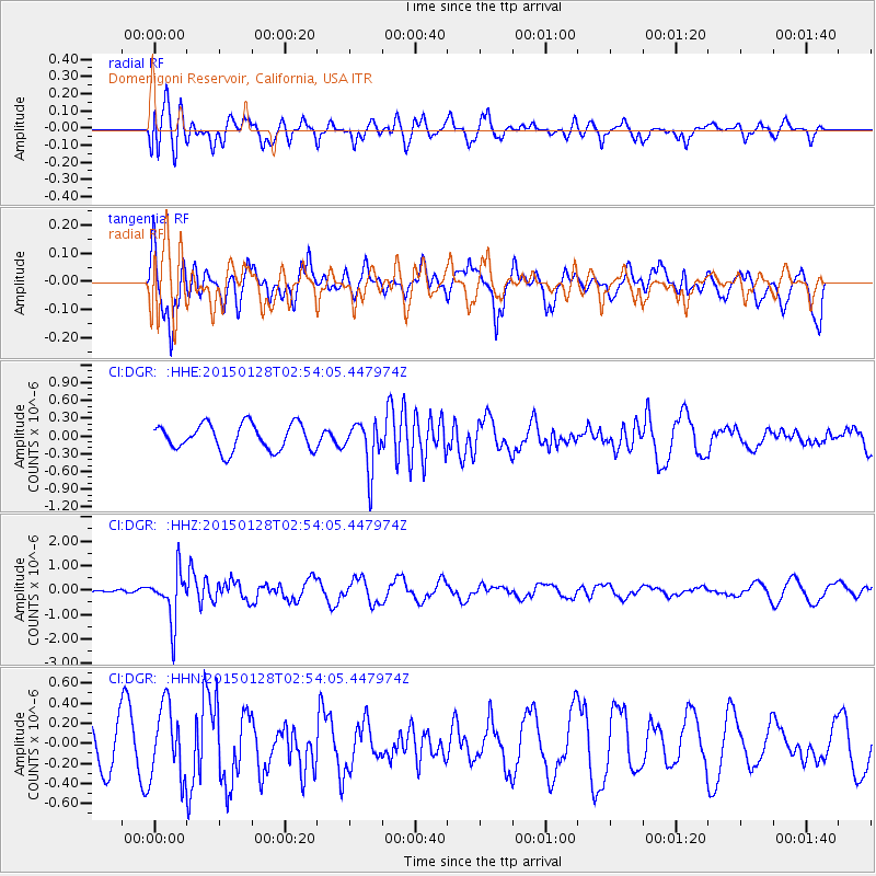
DGR Domenigoni Reservoir, California, USA - Earthquake Result Viewer
*The percent match for this event was below the threshold and hence no stack was calculated.
| Earthquake location: |
Fiji Islands Region |
| Earthquake latitude/longitude: |
-20.9/-178.4 |
| Earthquake time(UTC): |
2015/01/28 (028) 02:43:19 GMT |
| Earthquake Depth: |
484 km |
| Earthquake Magnitude: |
6.1 MWP |
| Earthquake Catalog/Contributor: |
NEIC PDE/NEIC COMCAT |
|
| Network: |
CI Caltech Regional Seismic Network |
| Station: |
DGR Domenigoni Reservoir, California, USA |
| Lat/Lon: |
33.65 N/117.01 W |
| Elevation: |
609 m |
|
| Distance: |
79.7 deg |
| Az: |
48.064 deg |
| Baz: |
236.49 deg |
| Ray Param: |
$rayparam |
*The percent match for this event was below the threshold and hence was not used in the summary stack. |
|
| Radial Match: |
56.277832 % |
| Radial Bump: |
400 |
| Transverse Match: |
54.241398 % |
| Transverse Bump: |
400 |
| SOD ConfigId: |
3390531 |
| Insert Time: |
2019-04-16 04:39:57.289 +0000 |
| GWidth: |
2.5 |
| Max Bumps: |
400 |
| Tol: |
0.001 |
|
Signal To Noise
| Channel | StoN | STA | LTA |
| CI:DGR: :HHZ:20150128T02:54:05.447974Z | 5.7544518 | 1.0148567E-6 | 1.7636029E-7 |
| CI:DGR: :HHN:20150128T02:54:05.447974Z | 1.6370825 | 3.553585E-7 | 2.1706818E-7 |
| CI:DGR: :HHE:20150128T02:54:05.447974Z | 1.8195148 | 4.0285522E-7 | 2.2140806E-7 |
| Arrivals |
| Ps | |
| PpPs | |
| PsPs/PpSs | |


