You are here: Home > Network List > CI - Caltech Regional Seismic Network Stations List
> Station SWS Sam W. Stewart, Westmorland, CA, USA > Earthquake Result Viewer
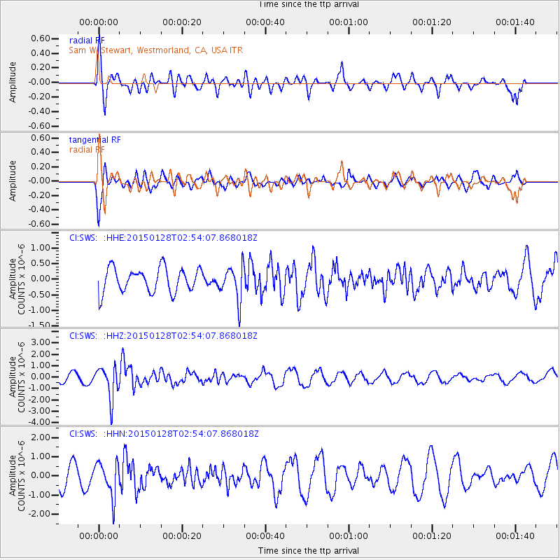
SWS Sam W. Stewart, Westmorland, CA, USA - Earthquake Result Viewer
*The percent match for this event was below the threshold and hence no stack was calculated.
| Earthquake location: |
Fiji Islands Region |
| Earthquake latitude/longitude: |
-20.9/-178.4 |
| Earthquake time(UTC): |
2015/01/28 (028) 02:43:19 GMT |
| Earthquake Depth: |
484 km |
| Earthquake Magnitude: |
6.1 MWP |
| Earthquake Catalog/Contributor: |
NEIC PDE/NEIC COMCAT |
|
| Network: |
CI Caltech Regional Seismic Network |
| Station: |
SWS Sam W. Stewart, Westmorland, CA, USA |
| Lat/Lon: |
32.94 N/115.80 W |
| Elevation: |
140 m |
|
| Distance: |
80.2 deg |
| Az: |
49.229 deg |
| Baz: |
237.356 deg |
| Ray Param: |
$rayparam |
*The percent match for this event was below the threshold and hence was not used in the summary stack. |
|
| Radial Match: |
67.323715 % |
| Radial Bump: |
400 |
| Transverse Match: |
79.653854 % |
| Transverse Bump: |
400 |
| SOD ConfigId: |
3390531 |
| Insert Time: |
2019-04-16 04:40:27.658 +0000 |
| GWidth: |
2.5 |
| Max Bumps: |
400 |
| Tol: |
0.001 |
|
Signal To Noise
| Channel | StoN | STA | LTA |
| CI:SWS: :HHZ:20150128T02:54:07.868018Z | 3.7638528 | 1.4159671E-6 | 3.762015E-7 |
| CI:SWS: :HHN:20150128T02:54:07.868018Z | 2.058565 | 9.0837676E-7 | 4.4126702E-7 |
| CI:SWS: :HHE:20150128T02:54:07.868018Z | 1.4597659 | 5.5641954E-7 | 3.811704E-7 |
| Arrivals |
| Ps | |
| PpPs | |
| PsPs/PpSs | |


