
KBL Kabul, Afghanistan - Earthquake Result Viewer
| ||||||||||||||||||
| ||||||||||||||||||
| ||||||||||||||||||
|
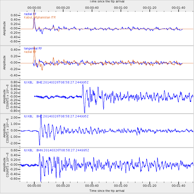
Signal To Noise
| Channel | StoN | STA | LTA |
| IU:KBL: :BHZ:20140326T08:58:27.244995Z | 13.74802 | 1.0034153E-6 | 7.298617E-8 |
| IU:KBL: :BHN:20140326T08:58:27.244995Z | 5.892289 | 2.1905007E-7 | 3.7175717E-8 |
| IU:KBL: :BHE:20140326T08:58:27.244995Z | 7.5289235 | 2.7851718E-7 | 3.699296E-8 |
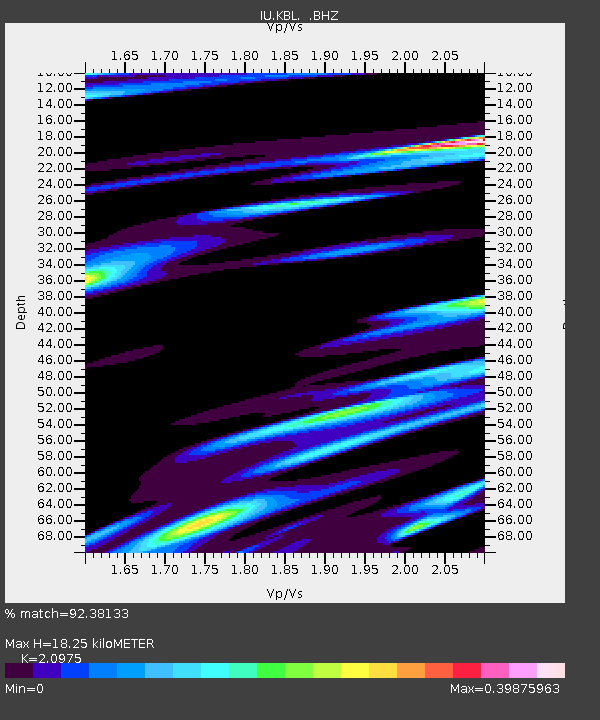
| Arrivals | |
| Ps | 3.2 SECOND |
| PpPs | 8.1 SECOND |
| PsPs/PpSs | 11 SECOND |

