You are here: Home > Network List > TJ - Tajikistan National Seismic Network Stations List
> Station GARM Garm, Tajikistan > Earthquake Result Viewer
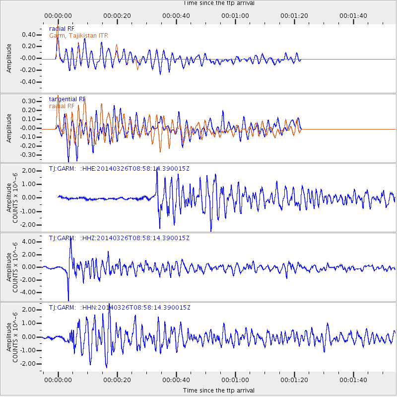
GARM Garm, Tajikistan - Earthquake Result Viewer
*The percent match for this event was below the threshold and hence no stack was calculated.
| Earthquake location: |
Southeast Of Ryukyu Islands |
| Earthquake latitude/longitude: |
28.2/131.5 |
| Earthquake time(UTC): |
2014/03/26 (085) 08:49:41 GMT |
| Earthquake Depth: |
10 km |
| Earthquake Magnitude: |
5.6 MWP, 1.0 MI, 5.4 MWC, 5.5 MWW |
| Earthquake Catalog/Contributor: |
NEIC PDE/NEIC COMCAT |
|
| Network: |
TJ Tajikistan National Seismic Network |
| Station: |
GARM Garm, Tajikistan |
| Lat/Lon: |
39.00 N/70.32 E |
| Elevation: |
1305 m |
|
| Distance: |
51.2 deg |
| Az: |
298.904 deg |
| Baz: |
82.708 deg |
| Ray Param: |
$rayparam |
*The percent match for this event was below the threshold and hence was not used in the summary stack. |
|
| Radial Match: |
75.76863 % |
| Radial Bump: |
400 |
| Transverse Match: |
74.5397 % |
| Transverse Bump: |
372 |
| SOD ConfigId: |
626651 |
| Insert Time: |
2014-04-21 14:13:41.924 +0000 |
| GWidth: |
2.5 |
| Max Bumps: |
400 |
| Tol: |
0.001 |
|
Signal To Noise
| Channel | StoN | STA | LTA |
| TJ:GARM: :HHZ:20140326T08:58:14.390015Z | 8.222992 | 1.7720492E-6 | 2.1549933E-7 |
| TJ:GARM: :HHN:20140326T08:58:14.390015Z | 1.432026 | 1.9662161E-7 | 1.373031E-7 |
| TJ:GARM: :HHE:20140326T08:58:14.390015Z | 13.144484 | 7.584496E-7 | 5.770098E-8 |
| Arrivals |
| Ps | |
| PpPs | |
| PsPs/PpSs | |


