You are here: Home > Network List > UW - Pacific Northwest Regional Seismic Network Stations List
> Station UMAT Pilot Rock, OR, USA > Earthquake Result Viewer
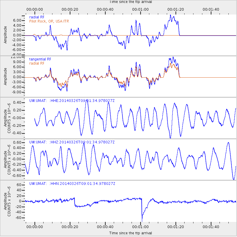
UMAT Pilot Rock, OR, USA - Earthquake Result Viewer
*The percent match for this event was below the threshold and hence no stack was calculated.
| Earthquake location: |
Southeast Of Ryukyu Islands |
| Earthquake latitude/longitude: |
28.2/131.5 |
| Earthquake time(UTC): |
2014/03/26 (085) 08:49:41 GMT |
| Earthquake Depth: |
10 km |
| Earthquake Magnitude: |
5.6 MWP, 1.0 MI, 5.4 MWC, 5.5 MWW |
| Earthquake Catalog/Contributor: |
NEIC PDE/NEIC COMCAT |
|
| Network: |
UW Pacific Northwest Regional Seismic Network |
| Station: |
UMAT Pilot Rock, OR, USA |
| Lat/Lon: |
45.29 N/118.96 W |
| Elevation: |
1318 m |
|
| Distance: |
82.9 deg |
| Az: |
42.09 deg |
| Baz: |
303.034 deg |
| Ray Param: |
$rayparam |
*The percent match for this event was below the threshold and hence was not used in the summary stack. |
|
| Radial Match: |
30.059814 % |
| Radial Bump: |
400 |
| Transverse Match: |
30.020632 % |
| Transverse Bump: |
400 |
| SOD ConfigId: |
626651 |
| Insert Time: |
2014-04-21 14:15:26.841 +0000 |
| GWidth: |
2.5 |
| Max Bumps: |
400 |
| Tol: |
0.001 |
|
Signal To Noise
| Channel | StoN | STA | LTA |
| UW:UMAT: :HHZ:20140326T09:01:34.978027Z | 1.1050823 | 3.1451015E-7 | 2.8460337E-7 |
| UW:UMAT: :HHN:20140326T09:01:34.978027Z | 1.1530157 | 3.1546344E-6 | 2.7359854E-6 |
| UW:UMAT: :HHE:20140326T09:01:34.978027Z | 2.2752705 | 3.0015462E-7 | 1.319204E-7 |
| Arrivals |
| Ps | |
| PpPs | |
| PsPs/PpSs | |


