You are here: Home > Network List > TA - USArray Transportable Network (new EarthScope stations) Stations List
> Station A21K Barrow, AK, USA > Earthquake Result Viewer
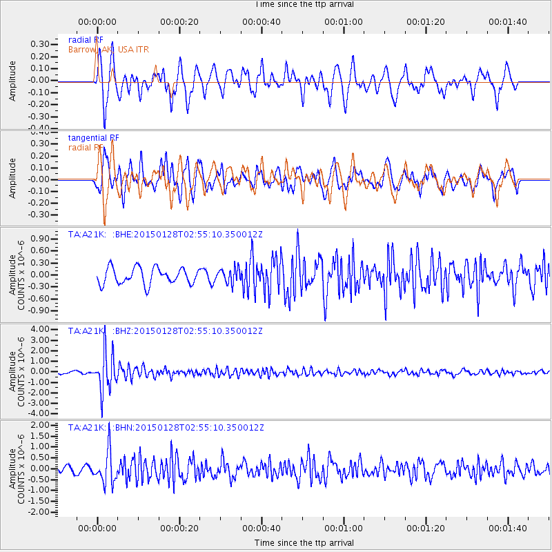
A21K Barrow, AK, USA - Earthquake Result Viewer
*The percent match for this event was below the threshold and hence no stack was calculated.
| Earthquake location: |
Fiji Islands Region |
| Earthquake latitude/longitude: |
-20.9/-178.4 |
| Earthquake time(UTC): |
2015/01/28 (028) 02:43:19 GMT |
| Earthquake Depth: |
484 km |
| Earthquake Magnitude: |
6.1 MWP |
| Earthquake Catalog/Contributor: |
NEIC PDE/NEIC COMCAT |
|
| Network: |
TA USArray Transportable Network (new EarthScope stations) |
| Station: |
A21K Barrow, AK, USA |
| Lat/Lon: |
71.32 N/156.62 W |
| Elevation: |
577 m |
|
| Distance: |
93.2 deg |
| Az: |
6.863 deg |
| Baz: |
200.289 deg |
| Ray Param: |
$rayparam |
*The percent match for this event was below the threshold and hence was not used in the summary stack. |
|
| Radial Match: |
61.68071 % |
| Radial Bump: |
400 |
| Transverse Match: |
67.59222 % |
| Transverse Bump: |
400 |
| SOD ConfigId: |
3390531 |
| Insert Time: |
2019-04-16 04:42:53.245 +0000 |
| GWidth: |
2.5 |
| Max Bumps: |
400 |
| Tol: |
0.001 |
|
Signal To Noise
| Channel | StoN | STA | LTA |
| TA:A21K: :BHZ:20150128T02:55:10.350012Z | 16.018715 | 1.8588436E-6 | 1.16041996E-7 |
| TA:A21K: :BHN:20150128T02:55:10.350012Z | 3.628147 | 7.5356587E-7 | 2.0769993E-7 |
| TA:A21K: :BHE:20150128T02:55:10.350012Z | 0.89177984 | 1.8255875E-7 | 2.0471279E-7 |
| Arrivals |
| Ps | |
| PpPs | |
| PsPs/PpSs | |


