You are here: Home > Network List > TA - USArray Transportable Network (new EarthScope stations) Stations List
> Station D04E Lakebay, WA, USA > Earthquake Result Viewer
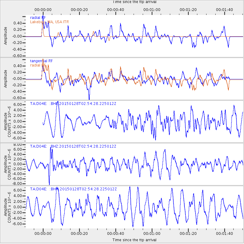
D04E Lakebay, WA, USA - Earthquake Result Viewer
*The percent match for this event was below the threshold and hence no stack was calculated.
| Earthquake location: |
Fiji Islands Region |
| Earthquake latitude/longitude: |
-20.9/-178.4 |
| Earthquake time(UTC): |
2015/01/28 (028) 02:43:19 GMT |
| Earthquake Depth: |
484 km |
| Earthquake Magnitude: |
6.1 MWP |
| Earthquake Catalog/Contributor: |
NEIC PDE/NEIC COMCAT |
|
| Network: |
TA USArray Transportable Network (new EarthScope stations) |
| Station: |
D04E Lakebay, WA, USA |
| Lat/Lon: |
47.18 N/122.77 W |
| Elevation: |
45 m |
|
| Distance: |
84.2 deg |
| Az: |
34.446 deg |
| Baz: |
230.826 deg |
| Ray Param: |
$rayparam |
*The percent match for this event was below the threshold and hence was not used in the summary stack. |
|
| Radial Match: |
61.31216 % |
| Radial Bump: |
400 |
| Transverse Match: |
71.73708 % |
| Transverse Bump: |
400 |
| SOD ConfigId: |
3390531 |
| Insert Time: |
2019-04-16 04:42:54.664 +0000 |
| GWidth: |
2.5 |
| Max Bumps: |
400 |
| Tol: |
0.001 |
|
Signal To Noise
| Channel | StoN | STA | LTA |
| TA:D04E: :BHZ:20150128T02:54:28.225012Z | 2.341273 | 3.0445128E-6 | 1.3003665E-6 |
| TA:D04E: :BHN:20150128T02:54:28.225012Z | 0.6880587 | 1.7663382E-6 | 2.5671332E-6 |
| TA:D04E: :BHE:20150128T02:54:28.225012Z | 0.48881897 | 1.3717066E-6 | 2.8061647E-6 |
| Arrivals |
| Ps | |
| PpPs | |
| PsPs/PpSs | |


