You are here: Home > Network List > TA - USArray Transportable Network (new EarthScope stations) Stations List
> Station J01E Myrtle Point, OR, USA > Earthquake Result Viewer
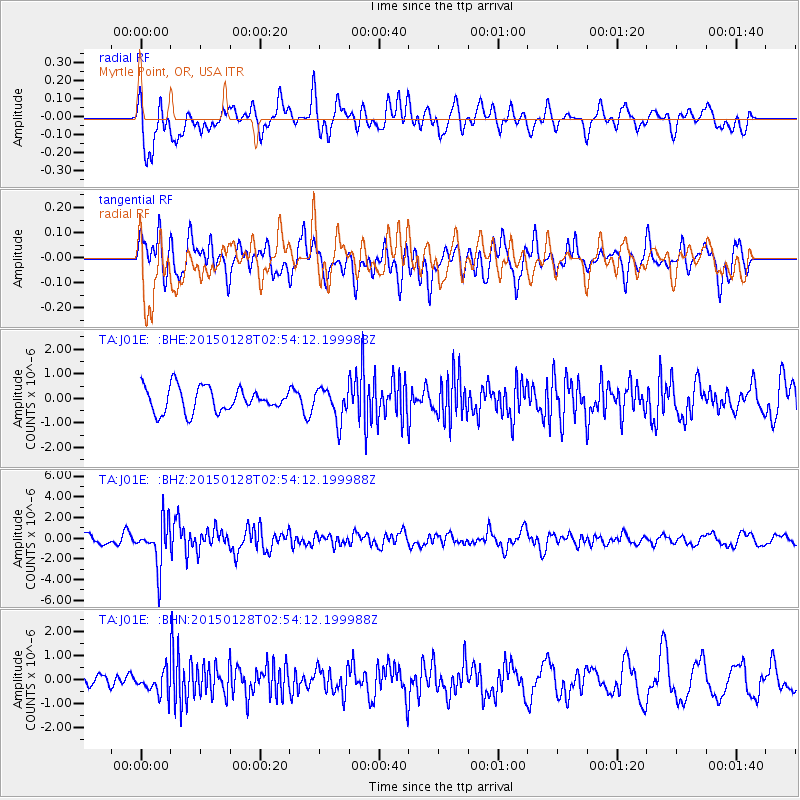
J01E Myrtle Point, OR, USA - Earthquake Result Viewer
*The percent match for this event was below the threshold and hence no stack was calculated.
| Earthquake location: |
Fiji Islands Region |
| Earthquake latitude/longitude: |
-20.9/-178.4 |
| Earthquake time(UTC): |
2015/01/28 (028) 02:43:19 GMT |
| Earthquake Depth: |
484 km |
| Earthquake Magnitude: |
6.1 MWP |
| Earthquake Catalog/Contributor: |
NEIC PDE/NEIC COMCAT |
|
| Network: |
TA USArray Transportable Network (new EarthScope stations) |
| Station: |
J01E Myrtle Point, OR, USA |
| Lat/Lon: |
43.16 N/123.93 W |
| Elevation: |
128 m |
|
| Distance: |
81.0 deg |
| Az: |
37.05 deg |
| Baz: |
230.341 deg |
| Ray Param: |
$rayparam |
*The percent match for this event was below the threshold and hence was not used in the summary stack. |
|
| Radial Match: |
66.81457 % |
| Radial Bump: |
400 |
| Transverse Match: |
58.769924 % |
| Transverse Bump: |
400 |
| SOD ConfigId: |
3390531 |
| Insert Time: |
2019-04-16 04:43:08.825 +0000 |
| GWidth: |
2.5 |
| Max Bumps: |
400 |
| Tol: |
0.001 |
|
Signal To Noise
| Channel | StoN | STA | LTA |
| TA:J01E: :BHZ:20150128T02:54:12.199988Z | 3.6043036 | 2.120929E-6 | 5.8844347E-7 |
| TA:J01E: :BHN:20150128T02:54:12.199988Z | 1.5190116 | 4.703381E-7 | 3.096343E-7 |
| TA:J01E: :BHE:20150128T02:54:12.199988Z | 1.3387101 | 6.556925E-7 | 4.897942E-7 |
| Arrivals |
| Ps | |
| PpPs | |
| PsPs/PpSs | |


