
NNA Nana, Peru - Earthquake Result Viewer
| ||||||||||||||||||
| ||||||||||||||||||
| ||||||||||||||||||
|
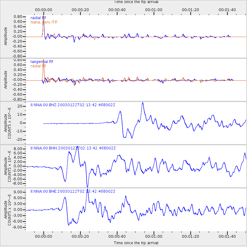
Signal To Noise
| Channel | StoN | STA | LTA |
| II:NNA:00:BHN:20030122T02:13:42.468002Z | 4.5473247 | 4.2185192E-7 | 9.2769255E-8 |
| II:NNA:00:BHE:20030122T02:13:42.468002Z | 3.0037146 | 4.6419174E-7 | 1.5453924E-7 |
| II:NNA:00:BHZ:20030122T02:13:42.468002Z | 5.724503 | 8.721957E-7 | 1.523618E-7 |
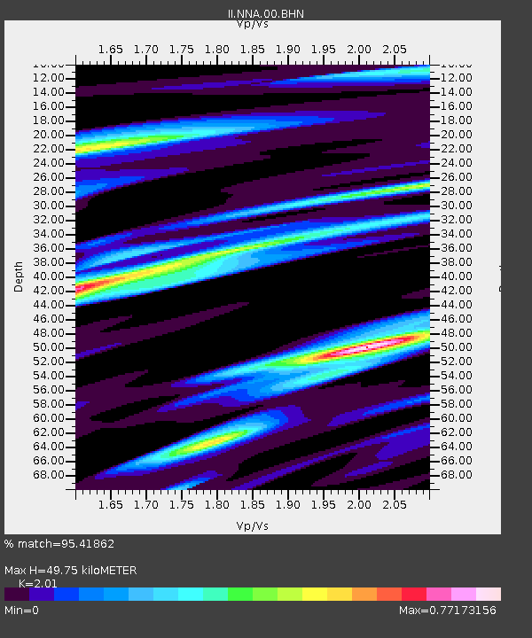
| Arrivals | |
| Ps | 8.3 SECOND |
| PpPs | 22 SECOND |
| PsPs/PpSs | 30 SECOND |

