You are here: Home > Network List > UW - Pacific Northwest Regional Seismic Network Stations List
> Station MRBL Marblemount, WA, USA > Earthquake Result Viewer
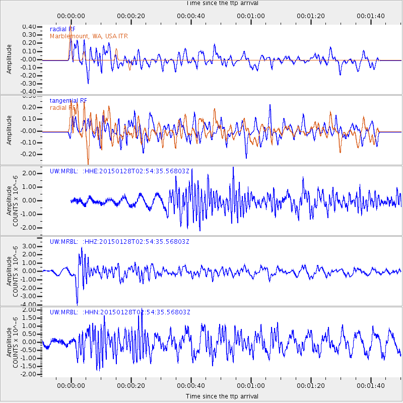
MRBL Marblemount, WA, USA - Earthquake Result Viewer
*The percent match for this event was below the threshold and hence no stack was calculated.
| Earthquake location: |
Fiji Islands Region |
| Earthquake latitude/longitude: |
-20.9/-178.4 |
| Earthquake time(UTC): |
2015/01/28 (028) 02:43:19 GMT |
| Earthquake Depth: |
484 km |
| Earthquake Magnitude: |
6.1 MWP |
| Earthquake Catalog/Contributor: |
NEIC PDE/NEIC COMCAT |
|
| Network: |
UW Pacific Northwest Regional Seismic Network |
| Station: |
MRBL Marblemount, WA, USA |
| Lat/Lon: |
48.52 N/121.48 W |
| Elevation: |
75 m |
|
| Distance: |
85.7 deg |
| Az: |
33.941 deg |
| Baz: |
231.733 deg |
| Ray Param: |
$rayparam |
*The percent match for this event was below the threshold and hence was not used in the summary stack. |
|
| Radial Match: |
66.78345 % |
| Radial Bump: |
400 |
| Transverse Match: |
58.630913 % |
| Transverse Bump: |
400 |
| SOD ConfigId: |
3390531 |
| Insert Time: |
2019-04-16 04:44:31.197 +0000 |
| GWidth: |
2.5 |
| Max Bumps: |
400 |
| Tol: |
0.001 |
|
Signal To Noise
| Channel | StoN | STA | LTA |
| UW:MRBL: :HHZ:20150128T02:54:35.56803Z | 5.1721807 | 1.5669186E-6 | 3.0295124E-7 |
| UW:MRBL: :HHN:20150128T02:54:35.56803Z | 2.028069 | 4.944423E-7 | 2.4379955E-7 |
| UW:MRBL: :HHE:20150128T02:54:35.56803Z | 2.9587514 | 6.341721E-7 | 2.1433775E-7 |
| Arrivals |
| Ps | |
| PpPs | |
| PsPs/PpSs | |


