NNA Nana, Peru - Earthquake Result Viewer
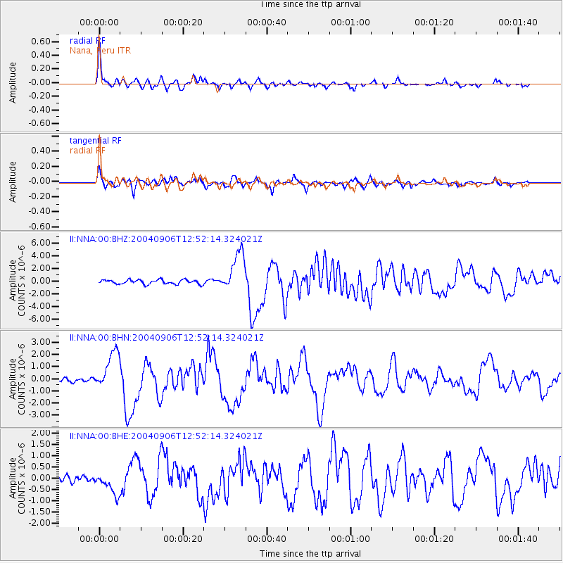
Earthquake location: South Sandwich Islands Region
Earthquake latitude/longitude: -55.4/-29.0
Earthquake time(UTC): 2004/09/06 (250) 12:42:59 GMT
Earthquake Depth: 10 km
Earthquake Magnitude: 6.0 MB, 6.5 MS, 6.9 MW, 6.8 MW
Earthquake Catalog/Contributor: WHDF/NEIC
Network: II Global Seismograph Network (GSN - IRIS/IDA)
Station: NNA Nana, Peru
Lat/Lon: 11.99 S/76.84 W
Elevation: 575 m
Distance: 57.0 deg
Az: 300.132 deg
Baz: 149.698 deg
Ray Param: 0.06375135
Estimated Moho Depth: 49.75 km
Estimated Crust Vp/Vs: 2.10
Assumed Crust Vp: 6.472 km/s
Estimated Crust Vs: 3.086 km/s
Estimated Crust Poisson's Ratio: 0.35
Radial Match: 91.91341 %
Radial Bump: 400
Transverse Match: 84.44378 %
Transverse Bump: 400
SOD ConfigId: 2459
Insert Time: 2010-03-01 19:48:09.778 +0000
GWidth: 2.5
Max Bumps: 400
Tol: 0.001

Signal To Noise

ChannelStoNSTALTA
II:NNA:00:BHN:20040906T12:52:14.324021Z11.7559341.6573806E-61.4098248E-7
II:NNA:00:BHE:20040906T12:52:14.324021Z2.72521045.0424654E-71.850303E-7
II:NNA:00:BHZ:20040906T12:52:14.324021Z9.6844343.2551022E-63.3611693E-7
Arrivals
Ps8.8 SECOND
PpPs23 SECOND
PsPs/PpSs32 SECOND