NNA Nana, Peru - Earthquake Result Viewer
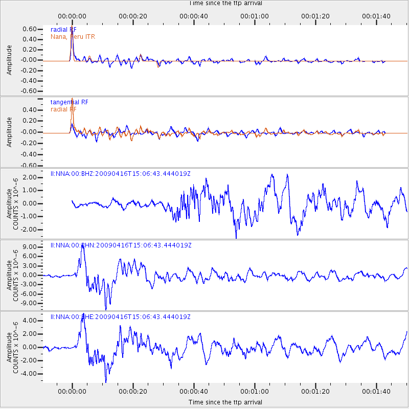
Earthquake location: South Sandwich Islands Region
Earthquake latitude/longitude: -60.2/-26.9
Earthquake time(UTC): 2009/04/16 (106) 14:57:06 GMT
Earthquake Depth: 20 km
Earthquake Magnitude: 6.2 MB, 6.8 MS, 6.7 MW, 6.7 MW
Earthquake Catalog/Contributor: WHDF/NEIC
Network: II Global Seismograph Network (GSN - IRIS/IDA)
Station: NNA Nana, Peru
Lat/Lon: 11.99 S/76.84 W
Elevation: 575 m
Distance: 60.5 deg
Az: 300.533 deg
Baz: 153.918 deg
Ray Param: 0.06149439
Estimated Moho Depth: 38.75 km
Estimated Crust Vp/Vs: 1.69
Assumed Crust Vp: 6.472 km/s
Estimated Crust Vs: 3.841 km/s
Estimated Crust Poisson's Ratio: 0.23
Radial Match: 94.56703 %
Radial Bump: 372
Transverse Match: 88.57892 %
Transverse Bump: 400
SOD ConfigId: 2658
Insert Time: 2010-03-01 19:48:12.271 +0000
GWidth: 2.5
Max Bumps: 400
Tol: 0.001

Signal To Noise

ChannelStoNSTALTA
II:NNA:00:BHN:20090416T15:06:43.444019Z16.994584.5892634E-62.700428E-7
II:NNA:00:BHE:20090416T15:06:43.444019Z12.6141662.3168352E-61.8366931E-7
II:NNA:00:BHZ:20090416T15:06:43.444019Z3.3848355.8451434E-71.7268623E-7
Arrivals
Ps4.3 SECOND
PpPs15 SECOND
PsPs/PpSs20 SECOND