NNA Nana, Peru - Earthquake Result Viewer
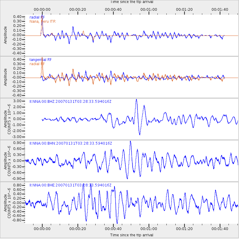
Earthquake location: Kermadec Islands, New Zealand
Earthquake latitude/longitude: -29.8/-178.0
Earthquake time(UTC): 2007/01/31 (031) 03:15:52 GMT
Earthquake Depth: 34 km
Earthquake Magnitude: 6.1 MB, 6.3 MS, 6.5 MW, 6.4 MW
Earthquake Catalog/Contributor: WHDF/NEIC
Network: II Global Seismograph Network (GSN - IRIS/IDA)
Station: NNA Nana, Peru
Lat/Lon: 11.99 S/76.84 W
Elevation: 575 m
Distance: 93.6 deg
Az: 105.874 deg
Baz: 238.721 deg
Ray Param: 0.041218534
Estimated Moho Depth: 26.25 km
Estimated Crust Vp/Vs: 1.91
Assumed Crust Vp: 6.472 km/s
Estimated Crust Vs: 3.388 km/s
Estimated Crust Poisson's Ratio: 0.31
Radial Match: 83.30308 %
Radial Bump: 400
Transverse Match: 76.93641 %
Transverse Bump: 400
SOD ConfigId: 2564
Insert Time: 2010-03-01 19:48:34.924 +0000
GWidth: 2.5
Max Bumps: 400
Tol: 0.001

Signal To Noise

ChannelStoNSTALTA
II:NNA:00:BHN:20070131T03:28:33.594016Z0.870987951.04282954E-71.197295E-7
II:NNA:00:BHE:20070131T03:28:33.594016Z2.1667232.1506484E-79.9258116E-8
II:NNA:00:BHZ:20070131T03:28:33.594016Z1.63928273.170755E-71.934233E-7
Arrivals
Ps3.8 SECOND
PpPs12 SECOND
PsPs/PpSs15 SECOND