
NNA Nana, Peru - Earthquake Result Viewer
| ||||||||||||||||||
| ||||||||||||||||||
| ||||||||||||||||||
|
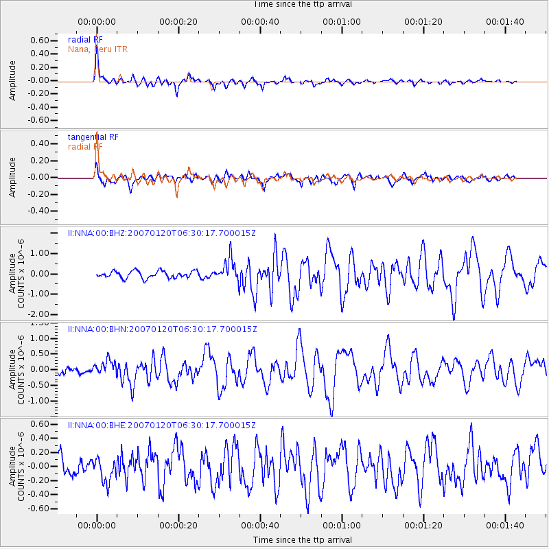
Signal To Noise
| Channel | StoN | STA | LTA |
| II:NNA:00:BHN:20070120T06:30:17.700015Z | 2.5636876 | 2.4990186E-7 | 9.74775E-8 |
| II:NNA:00:BHE:20070120T06:30:17.700015Z | 1.5507926 | 1.6917967E-7 | 1.0909238E-7 |
| II:NNA:00:BHZ:20070120T06:30:17.700015Z | 3.2967005 | 5.7049584E-7 | 1.7305055E-7 |
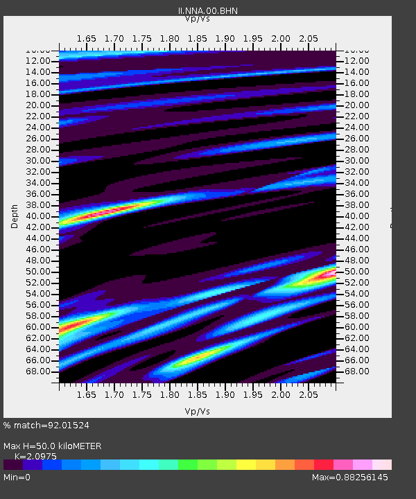
| Arrivals | |
| Ps | 8.9 SECOND |
| PpPs | 23 SECOND |
| PsPs/PpSs | 32 SECOND |

