NNA Nana, Peru - Earthquake Result Viewer
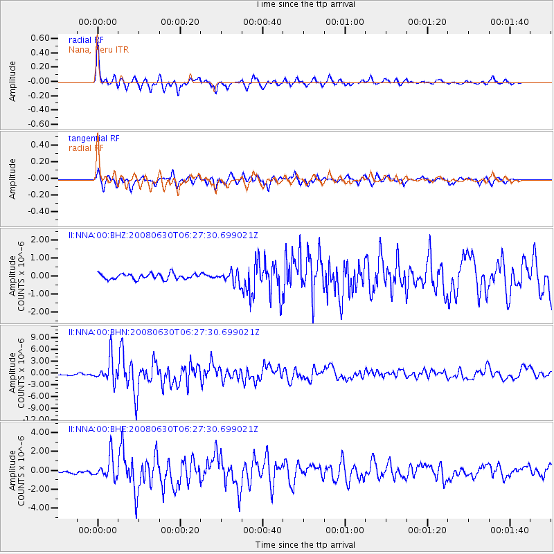
Earthquake location: South Sandwich Islands Region
Earthquake latitude/longitude: -58.2/-22.1
Earthquake time(UTC): 2008/06/30 (182) 06:17:44 GMT
Earthquake Depth: 19 km
Earthquake Magnitude: 6.1 MB, 6.7 MS, 7.0 MW, 6.9 MW
Earthquake Catalog/Contributor: WHDF/NEIC
Network: II Global Seismograph Network (GSN - IRIS/IDA)
Station: NNA Nana, Peru
Lat/Lon: 11.99 S/76.84 W
Elevation: 575 m
Distance: 61.7 deg
Az: 294.85 deg
Baz: 150.608 deg
Ray Param: 0.060684826
Estimated Moho Depth: 38.75 km
Estimated Crust Vp/Vs: 1.69
Assumed Crust Vp: 6.472 km/s
Estimated Crust Vs: 3.841 km/s
Estimated Crust Poisson's Ratio: 0.23
Radial Match: 88.36463 %
Radial Bump: 400
Transverse Match: 84.324196 %
Transverse Bump: 400
SOD ConfigId: 2504
Insert Time: 2010-03-01 19:48:40.700 +0000
GWidth: 2.5
Max Bumps: 400
Tol: 0.001

Signal To Noise

ChannelStoNSTALTA
II:NNA:00:BHN:20080630T06:27:30.699021Z15.8226763.179334E-62.009353E-7
II:NNA:00:BHE:20080630T06:27:30.699021Z8.4082671.2391018E-61.4736707E-7
II:NNA:00:BHZ:20080630T06:27:30.699021Z2.19861843.4191748E-71.555147E-7
Arrivals
Ps4.3 SECOND
PpPs15 SECOND
PsPs/PpSs20 SECOND