You are here: Home > Network List > UW - Pacific Northwest Regional Seismic Network Stations List
> Station UMAT Pilot Rock, OR, USA > Earthquake Result Viewer
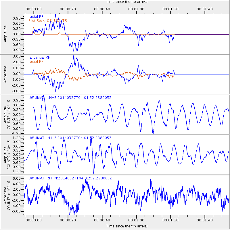
UMAT Pilot Rock, OR, USA - Earthquake Result Viewer
*The percent match for this event was below the threshold and hence no stack was calculated.
| Earthquake location: |
Santa Cruz Islands |
| Earthquake latitude/longitude: |
-12.1/166.5 |
| Earthquake time(UTC): |
2014/03/27 (086) 03:49:46 GMT |
| Earthquake Depth: |
112 km |
| Earthquake Magnitude: |
5.7 MB, 6.0 MWB, 6.0 MWW, 6.0 MWC |
| Earthquake Catalog/Contributor: |
NEIC PDE/NEIC COMCAT |
|
| Network: |
UW Pacific Northwest Regional Seismic Network |
| Station: |
UMAT Pilot Rock, OR, USA |
| Lat/Lon: |
45.29 N/118.96 W |
| Elevation: |
1318 m |
|
| Distance: |
87.9 deg |
| Az: |
42.9 deg |
| Baz: |
250.596 deg |
| Ray Param: |
$rayparam |
*The percent match for this event was below the threshold and hence was not used in the summary stack. |
|
| Radial Match: |
51.488846 % |
| Radial Bump: |
400 |
| Transverse Match: |
64.143974 % |
| Transverse Bump: |
400 |
| SOD ConfigId: |
626651 |
| Insert Time: |
2014-04-21 14:43:56.203 +0000 |
| GWidth: |
2.5 |
| Max Bumps: |
400 |
| Tol: |
0.001 |
|
Signal To Noise
| Channel | StoN | STA | LTA |
| UW:UMAT: :HHZ:20140327T04:01:52.238005Z | 2.211049 | 6.4895073E-7 | 2.9350355E-7 |
| UW:UMAT: :HHN:20140327T04:01:52.238005Z | 0.8840374 | 1.5808154E-6 | 1.7881771E-6 |
| UW:UMAT: :HHE:20140327T04:01:52.238005Z | 0.4524755 | 2.3829094E-7 | 5.2663836E-7 |
| Arrivals |
| Ps | |
| PpPs | |
| PsPs/PpSs | |


