NNA Nana, Peru - Earthquake Result Viewer
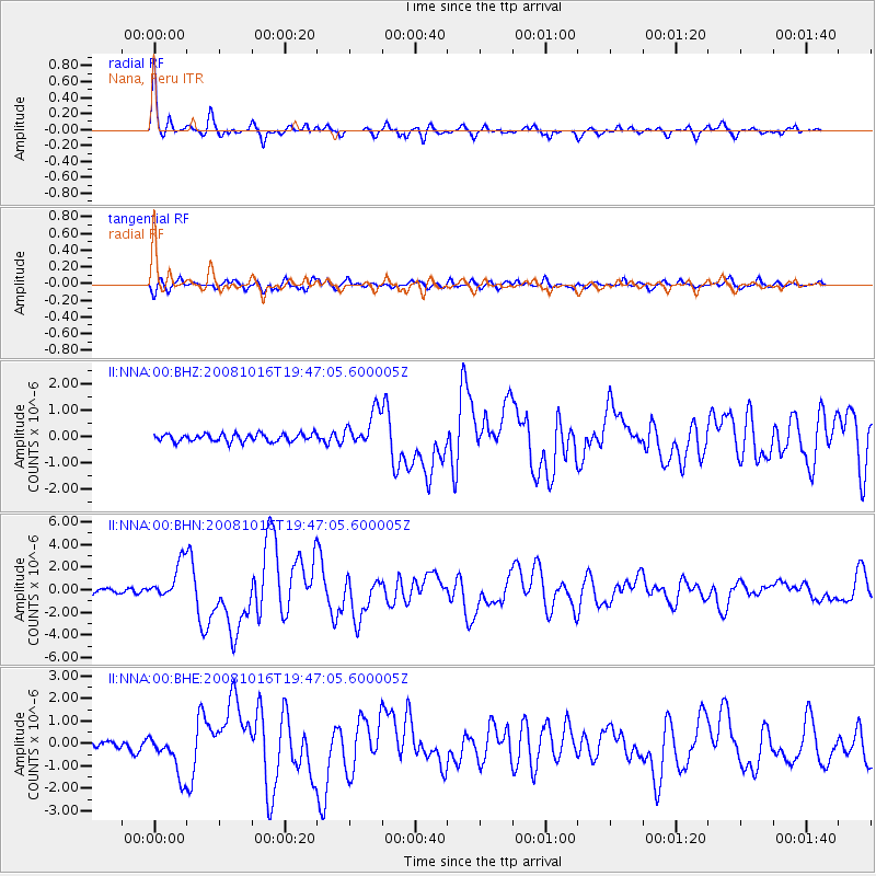
Earthquake location: Near Coast Of Chiapas, Mexico
Earthquake latitude/longitude: 14.4/-92.4
Earthquake time(UTC): 2008/10/16 (290) 19:41:25 GMT
Earthquake Depth: 24 km
Earthquake Magnitude: 6.1 MB, 6.6 MS, 6.7 MW, 6.6 MW
Earthquake Catalog/Contributor: WHDF/NEIC
Network: II Global Seismograph Network (GSN - IRIS/IDA)
Station: NNA Nana, Peru
Lat/Lon: 11.99 S/76.84 W
Elevation: 575 m
Distance: 30.4 deg
Az: 148.855 deg
Baz: 329.194 deg
Ray Param: 0.079319865
Estimated Moho Depth: 55.25 km
Estimated Crust Vp/Vs: 1.94
Assumed Crust Vp: 6.472 km/s
Estimated Crust Vs: 3.34 km/s
Estimated Crust Poisson's Ratio: 0.32
Radial Match: 91.352 %
Radial Bump: 331
Transverse Match: 80.503654 %
Transverse Bump: 400
SOD ConfigId: 2560
Insert Time: 2010-03-01 19:48:44.114 +0000
GWidth: 2.5
Max Bumps: 400
Tol: 0.001

Signal To Noise

ChannelStoNSTALTA
II:NNA:00:BHN:20081016T19:47:05.600005Z6.31249141.6431462E-62.6030077E-7
II:NNA:00:BHE:20081016T19:47:05.600005Z4.57905539.177612E-72.0042587E-7
II:NNA:00:BHZ:20081016T19:47:05.600005Z4.60024556.72552E-71.4619916E-7
Arrivals
Ps8.6 SECOND
PpPs23 SECOND
PsPs/PpSs32 SECOND