NNA Nana, Peru - Earthquake Result Viewer
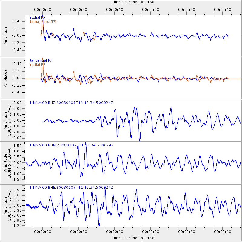
Earthquake location: Queen Charlotte Islands Region
Earthquake latitude/longitude: 51.3/-130.8
Earthquake time(UTC): 2008/01/05 (005) 11:01:05 GMT
Earthquake Depth: 10 km
Earthquake Magnitude: 6.0 MB, 6.5 MS, 6.6 MW, 6.6 MW
Earthquake Catalog/Contributor: WHDF/NEIC
Network: II Global Seismograph Network (GSN - IRIS/IDA)
Station: NNA Nana, Peru
Lat/Lon: 11.99 S/76.84 W
Elevation: 575 m
Distance: 78.4 deg
Az: 126.169 deg
Baz: 328.775 deg
Ray Param: 0.04968911
Estimated Moho Depth: 44.0 km
Estimated Crust Vp/Vs: 1.60
Assumed Crust Vp: 6.472 km/s
Estimated Crust Vs: 4.045 km/s
Estimated Crust Poisson's Ratio: 0.18
Radial Match: 87.58647 %
Radial Bump: 400
Transverse Match: 76.45915 %
Transverse Bump: 400
SOD ConfigId: 2564
Insert Time: 2010-03-01 19:49:12.590 +0000
GWidth: 2.5
Max Bumps: 400
Tol: 0.001

Signal To Noise

ChannelStoNSTALTA
II:NNA:00:BHN:20080105T11:12:34.500024Z1.72297811.9144755E-71.1111433E-7
II:NNA:00:BHE:20080105T11:12:34.500024Z1.87224472.387673E-71.2752997E-7
II:NNA:00:BHZ:20080105T11:12:34.500024Z4.241035.649275E-71.3320526E-7
Arrivals
Ps4.2 SECOND
PpPs17 SECOND
PsPs/PpSs21 SECOND