
NNA Nana, Peru - Earthquake Result Viewer
| ||||||||||||||||||
| ||||||||||||||||||
| ||||||||||||||||||
|
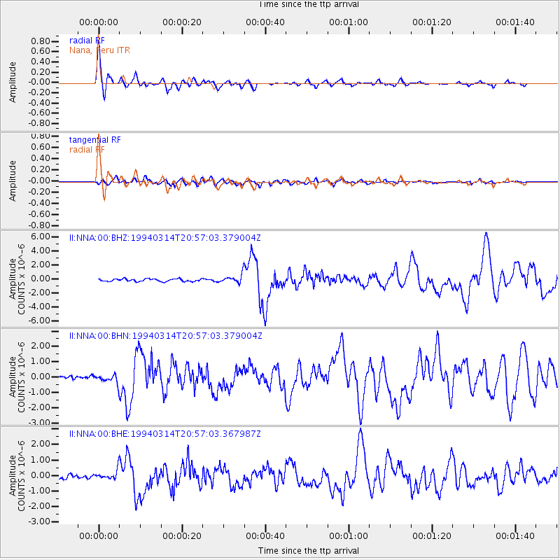
Signal To Noise
| Channel | StoN | STA | LTA |
| II:NNA:00:BHN:19940314T20:57:03.379004Z | 2.6717358 | 3.065887E-7 | 1.1475262E-7 |
| II:NNA:00:BHE:19940314T20:57:03.367987Z | 2.636537 | 3.322735E-7 | 1.2602648E-7 |
| II:NNA:00:BHZ:19940314T20:57:03.379004Z | 3.6027539 | 6.3964274E-7 | 1.7754273E-7 |
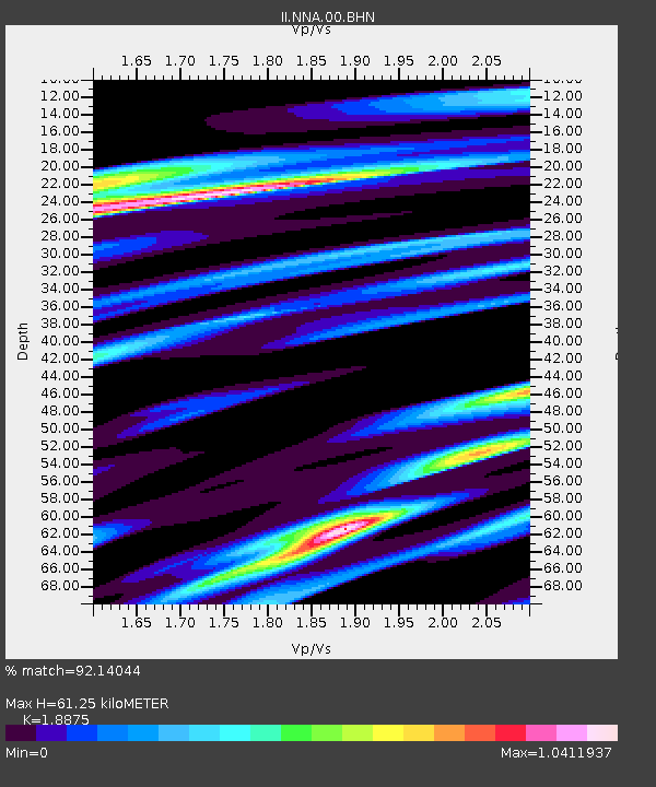
| Arrivals | |
| Ps | 9.1 SECOND |
| PpPs | 25 SECOND |
| PsPs/PpSs | 34 SECOND |

