You are here: Home > Network List > TA - USArray Transportable Network (new EarthScope stations) Stations List
> Station O48A Farmland, IN, USA > Earthquake Result Viewer
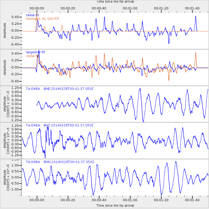
O48A Farmland, IN, USA - Earthquake Result Viewer
*The percent match for this event was below the threshold and hence no stack was calculated.
| Earthquake location: |
San Juan Province, Argentina |
| Earthquake latitude/longitude: |
-29.1/-68.7 |
| Earthquake time(UTC): |
2014/03/27 (086) 23:50:52 GMT |
| Earthquake Depth: |
9.9 km |
| Earthquake Magnitude: |
5.5 MWP, 5.6 MWB, 5.7 MWW, 5.7 MWC |
| Earthquake Catalog/Contributor: |
NEIC PDE/NEIC COMCAT |
|
| Network: |
TA USArray Transportable Network (new EarthScope stations) |
| Station: |
O48A Farmland, IN, USA |
| Lat/Lon: |
40.26 N/85.16 W |
| Elevation: |
300 m |
|
| Distance: |
70.7 deg |
| Az: |
346.728 deg |
| Baz: |
164.784 deg |
| Ray Param: |
$rayparam |
*The percent match for this event was below the threshold and hence was not used in the summary stack. |
|
| Radial Match: |
70.28795 % |
| Radial Bump: |
400 |
| Transverse Match: |
72.826706 % |
| Transverse Bump: |
400 |
| SOD ConfigId: |
626651 |
| Insert Time: |
2014-04-21 15:18:43.790 +0000 |
| GWidth: |
2.5 |
| Max Bumps: |
400 |
| Tol: |
0.001 |
|
Signal To Noise
| Channel | StoN | STA | LTA |
| TA:O48A: :BHZ:20140328T00:01:37.050Z | 2.3418736 | 7.118128E-7 | 3.0395012E-7 |
| TA:O48A: :BHN:20140328T00:01:37.050Z | 1.4341406 | 5.62393E-7 | 3.9214635E-7 |
| TA:O48A: :BHE:20140328T00:01:37.050Z | 2.237843 | 3.2195098E-7 | 1.4386664E-7 |
| Arrivals |
| Ps | |
| PpPs | |
| PsPs/PpSs | |


