NNA Nana, Peru - Earthquake Result Viewer
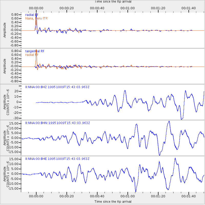
Earthquake location: Near Coast Of Jalisco, Mexico
Earthquake latitude/longitude: 19.1/-104.2
Earthquake time(UTC): 1995/10/09 (282) 15:35:55 GMT
Earthquake Depth: 49 km
Earthquake Magnitude: 6.5 MB, 7.3 MS, 7.3 UNKNOWN, 7.9 MW
Earthquake Catalog/Contributor: WHDF/NEIC
Network: II Global Seismograph Network (GSN - IRIS/IDA)
Station: NNA Nana, Peru
Lat/Lon: 11.99 S/76.84 W
Elevation: 575 m
Distance: 41.1 deg
Az: 136.753 deg
Baz: 318.551 deg
Ray Param: 0.073901795
Estimated Moho Depth: 47.75 km
Estimated Crust Vp/Vs: 2.06
Assumed Crust Vp: 6.472 km/s
Estimated Crust Vs: 3.146 km/s
Estimated Crust Poisson's Ratio: 0.35
Radial Match: 97.1388 %
Radial Bump: 334
Transverse Match: 86.53998 %
Transverse Bump: 400
SOD ConfigId: 61242
Insert Time: 2010-03-01 19:49:43.168 +0000
GWidth: 2.5
Max Bumps: 400
Tol: 0.001

Signal To Noise

ChannelStoNSTALTA
II:NNA:00:BHN:19951009T15:43:03.963Z2.6823787.889366E-72.9411834E-7
II:NNA:00:BHE:19951009T15:43:03.963Z2.85552148.282161E-72.9004025E-7
II:NNA:00:BHZ:19951009T15:43:03.963Z4.9654961.9043351E-63.8351357E-7
Arrivals
Ps8.3 SECOND
PpPs21 SECOND
PsPs/PpSs30 SECOND