
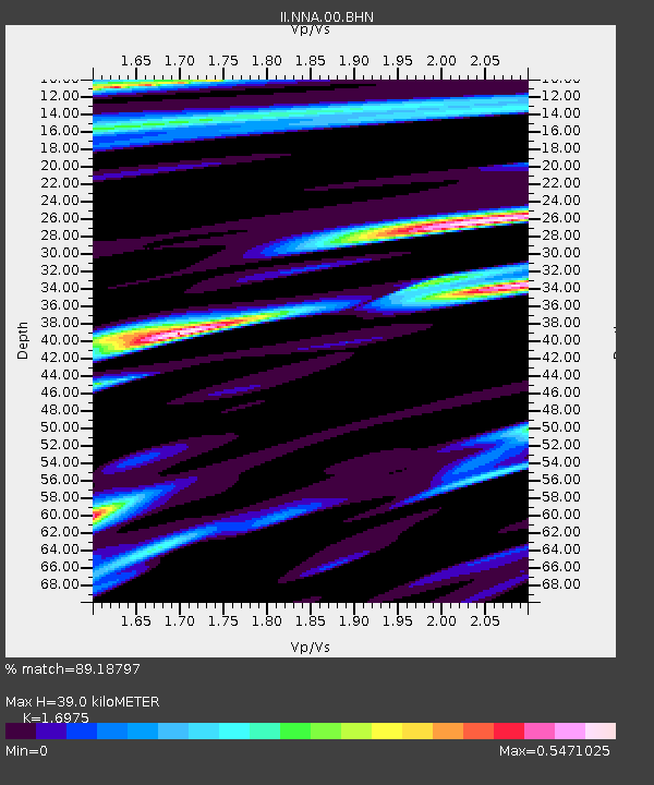
NNA Nana, Peru - Earthquake Result Viewer
| ||||||||||||||||||
| ||||||||||||||||||
| ||||||||||||||||||
|
Signal To Noise
| Channel | StoN | STA | LTA |
| II:NNA:00:BHN:19950818T02:25:40.096997Z | 0.8716092 | 1.5917398E-7 | 1.8262082E-7 |
| II:NNA:00:BHE:19950818T02:25:40.096997Z | 1.5286509 | 3.6625931E-7 | 2.3959646E-7 |
| II:NNA:00:BHZ:19950818T02:25:40.096997Z | 1.7727164 | 4.3682286E-7 | 2.464144E-7 |
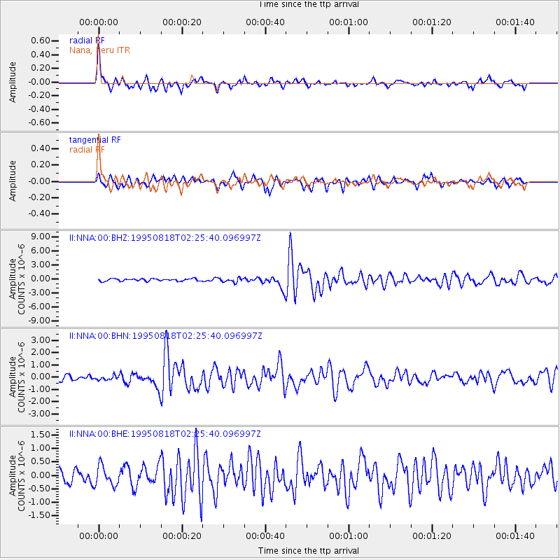
| Arrivals | |
| Ps | 4.4 SECOND |
| PpPs | 15 SECOND |
| PsPs/PpSs | 20 SECOND |

