You are here: Home > Network List > US - United States National Seismic Network Stations List
> Station HAWA Hanford, Washington, USA > Earthquake Result Viewer
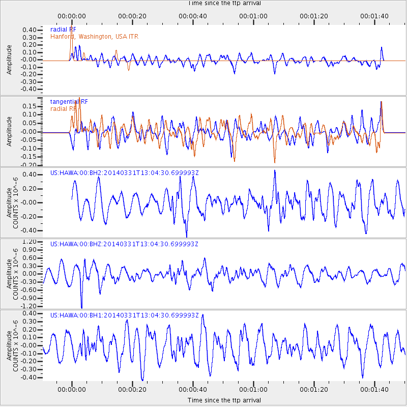
HAWA Hanford, Washington, USA - Earthquake Result Viewer
*The percent match for this event was below the threshold and hence no stack was calculated.
| Earthquake location: |
Northern Chile |
| Earthquake latitude/longitude: |
-19.5/-69.2 |
| Earthquake time(UTC): |
2014/03/31 (090) 12:53:05 GMT |
| Earthquake Depth: |
112 km |
| Earthquake Magnitude: |
5.6 MB, 5.5 MWB, 5.6 MWC, 5.6 MWW |
| Earthquake Catalog/Contributor: |
NEIC PDE/NEIC COMCAT |
|
| Network: |
US United States National Seismic Network |
| Station: |
HAWA Hanford, Washington, USA |
| Lat/Lon: |
46.39 N/119.53 W |
| Elevation: |
364 m |
|
| Distance: |
79.8 deg |
| Az: |
327.214 deg |
| Baz: |
132.444 deg |
| Ray Param: |
$rayparam |
*The percent match for this event was below the threshold and hence was not used in the summary stack. |
|
| Radial Match: |
45.83825 % |
| Radial Bump: |
400 |
| Transverse Match: |
46.354565 % |
| Transverse Bump: |
400 |
| SOD ConfigId: |
626651 |
| Insert Time: |
2014-04-21 17:16:21.137 +0000 |
| GWidth: |
2.5 |
| Max Bumps: |
400 |
| Tol: |
0.001 |
|
Signal To Noise
| Channel | StoN | STA | LTA |
| US:HAWA:00:BHZ:20140331T13:04:30.699993Z | 2.4717708 | 4.4377003E-7 | 1.7953526E-7 |
| US:HAWA:00:BH1:20140331T13:04:30.699993Z | 1.2167469 | 1.2588531E-7 | 1.0346055E-7 |
| US:HAWA:00:BH2:20140331T13:04:30.699993Z | 0.88901603 | 1.4053123E-7 | 1.5807503E-7 |
| Arrivals |
| Ps | |
| PpPs | |
| PsPs/PpSs | |


