
NNA Nana, Peru - Earthquake Result Viewer
| ||||||||||||||||||
| ||||||||||||||||||
| ||||||||||||||||||
|
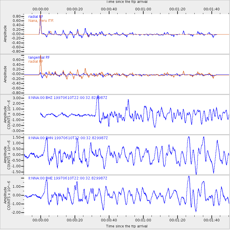
Signal To Noise
| Channel | StoN | STA | LTA |
| II:NNA:00:BHN:19970610T22:00:32.829987Z | 6.819356 | 6.7733066E-7 | 9.932472E-8 |
| II:NNA:00:BHE:19970610T22:00:32.829987Z | 6.601453 | 8.495822E-7 | 1.2869624E-7 |
| II:NNA:00:BHZ:19970610T22:00:32.829987Z | 8.7023735 | 1.5506296E-6 | 1.7818468E-7 |
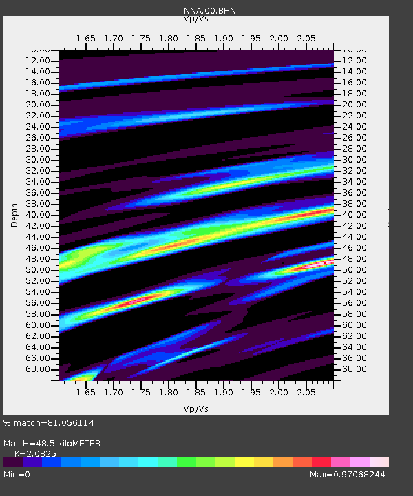
| Arrivals | |
| Ps | 8.6 SECOND |
| PpPs | 22 SECOND |
| PsPs/PpSs | 30 SECOND |

